Ware - then and now
Some pictures held in Hertfordshire Archives - mostly taken at the end of the 19th century - compared with similar views in the Spring of 2011
By Terry Askew
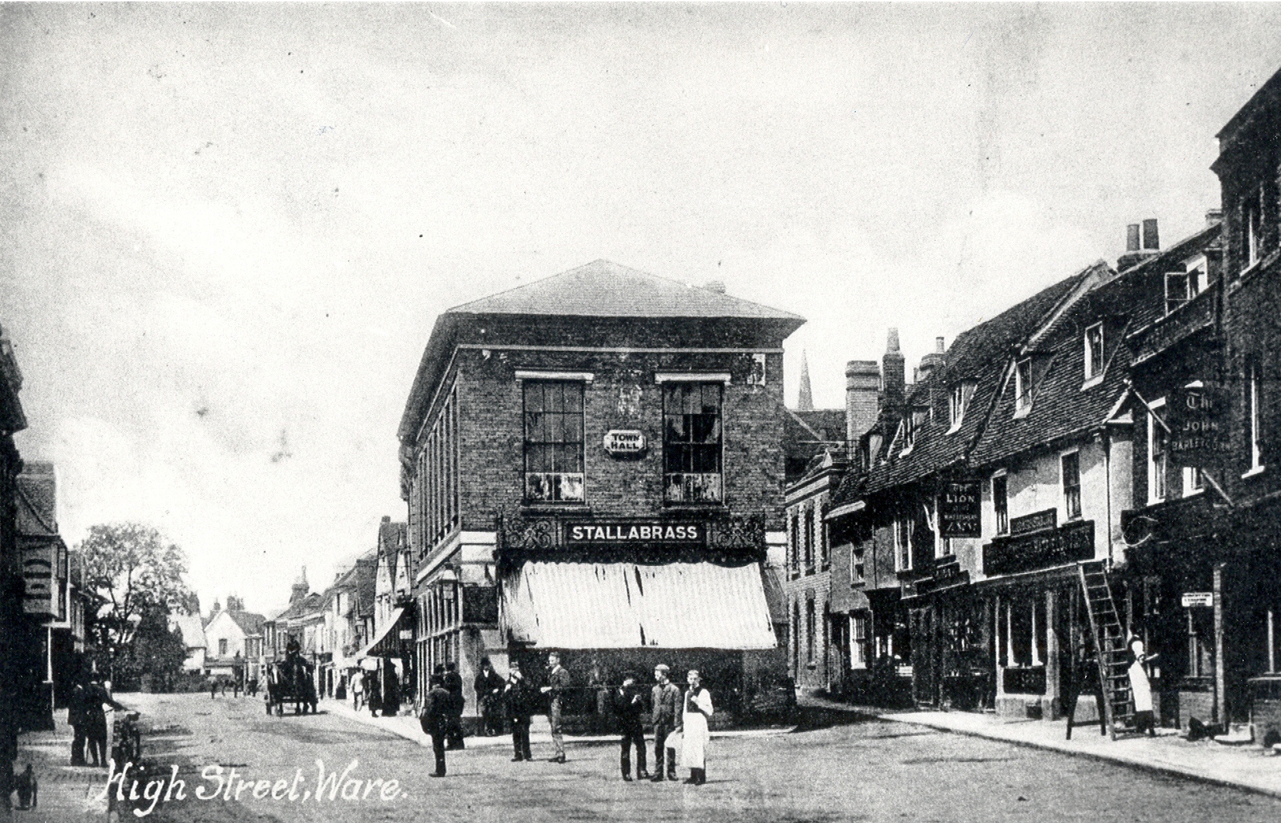
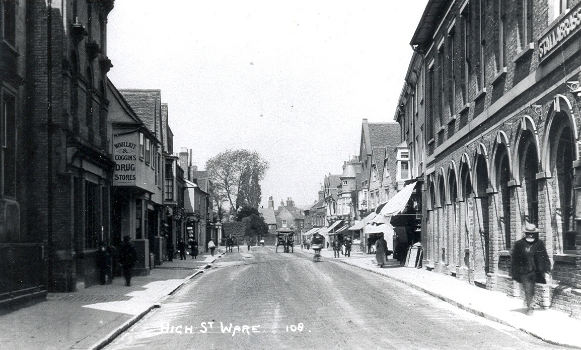
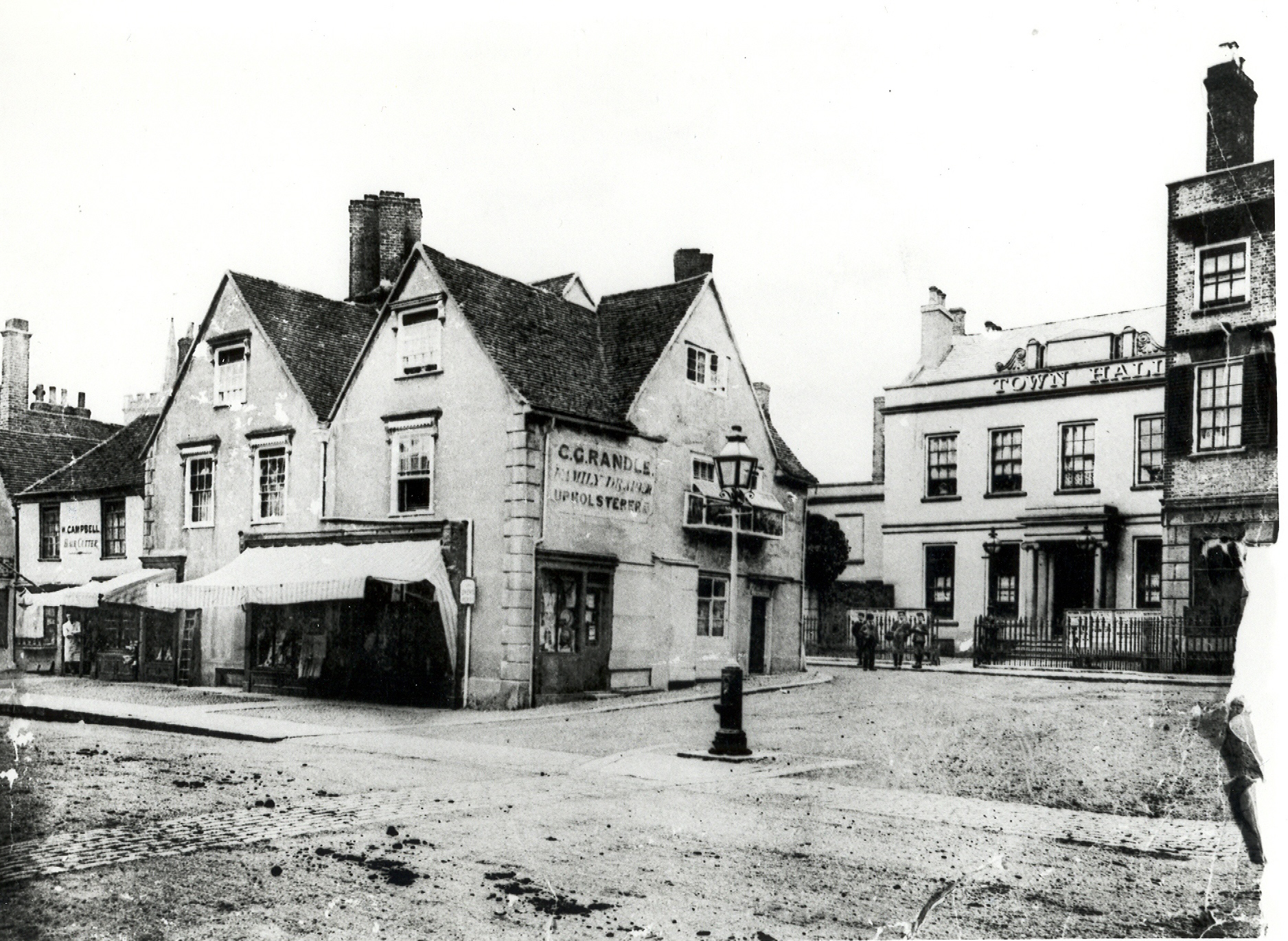
High Street - the old Town Hall
Hertfordshire Archives and Local Studies
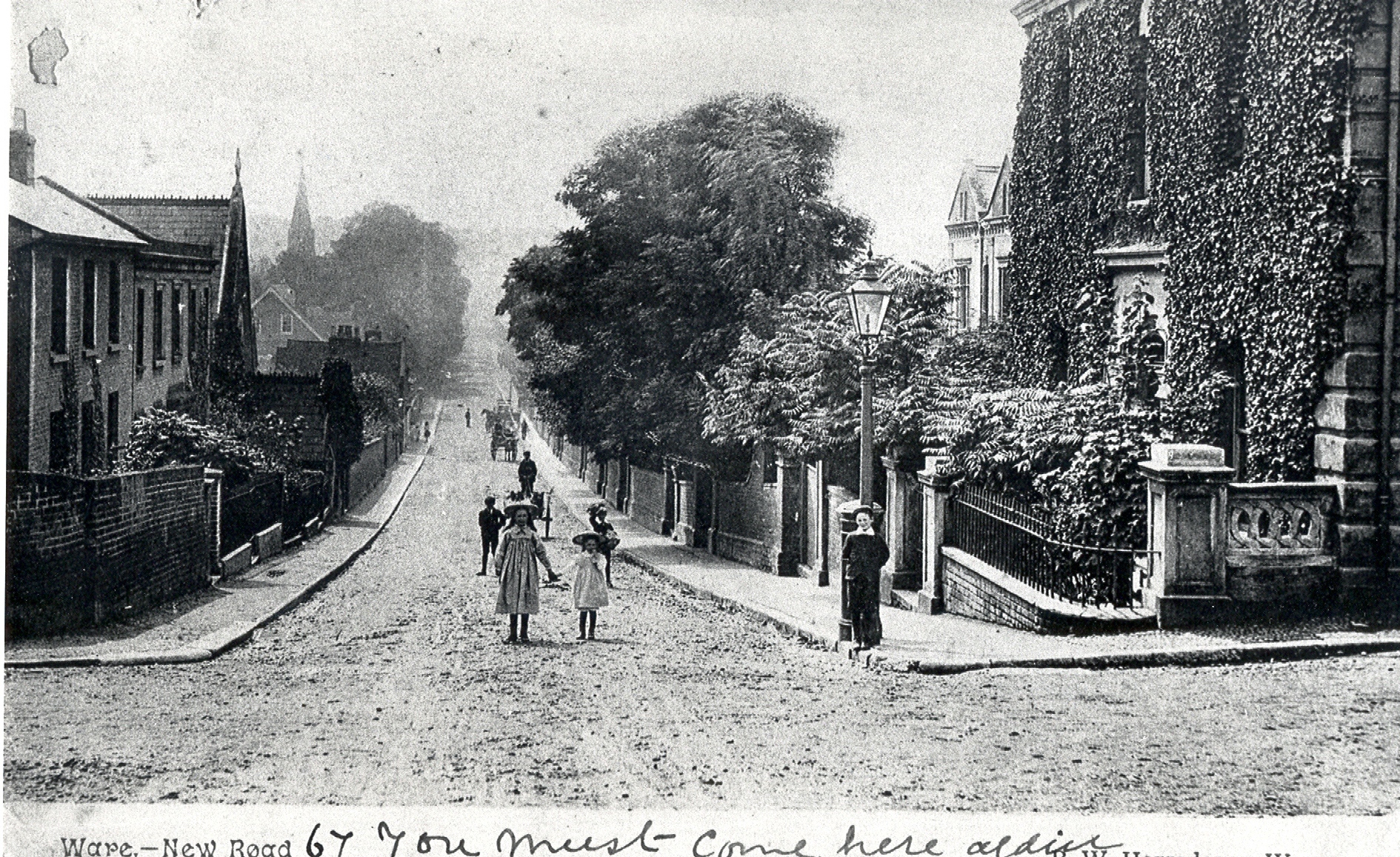
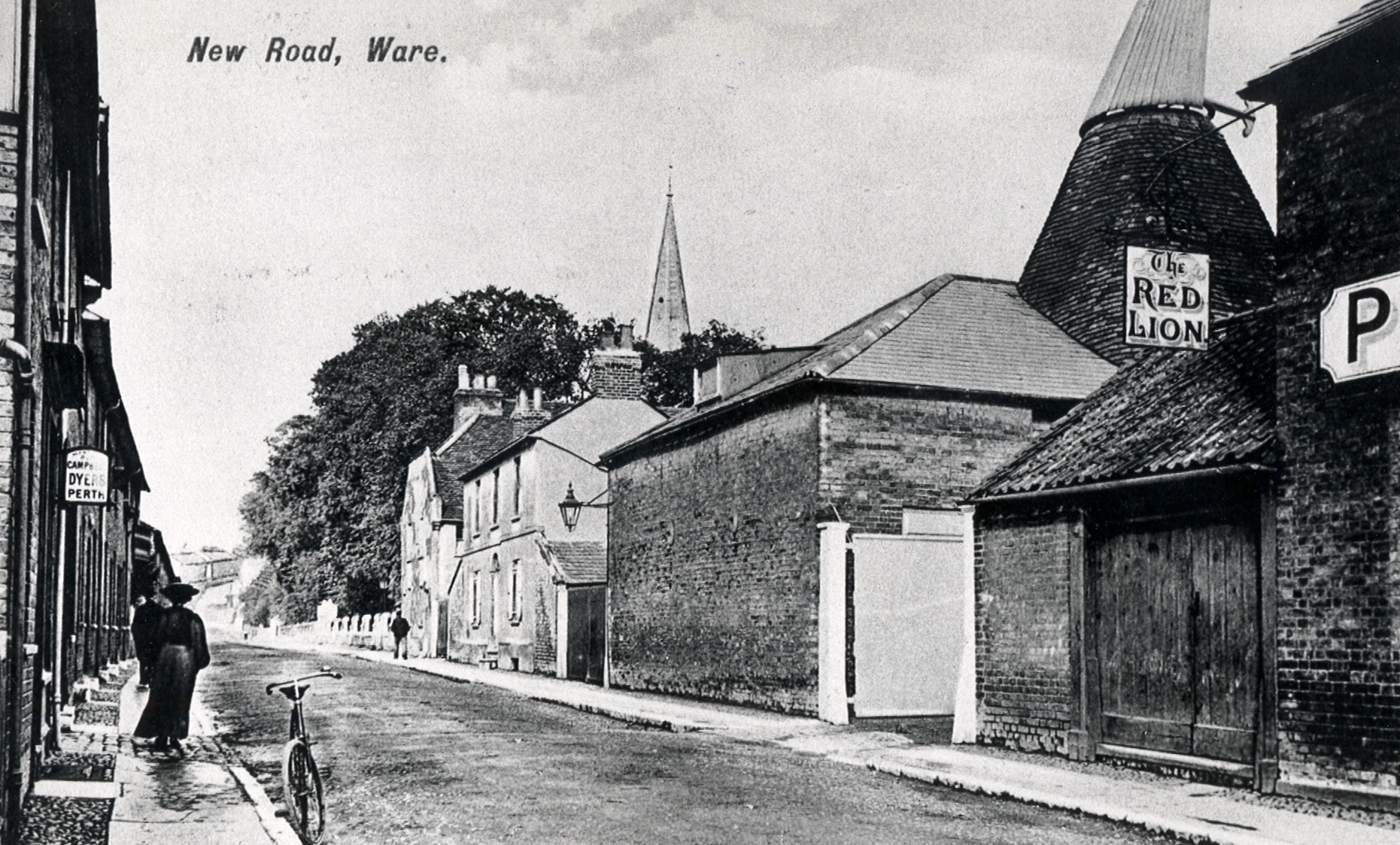
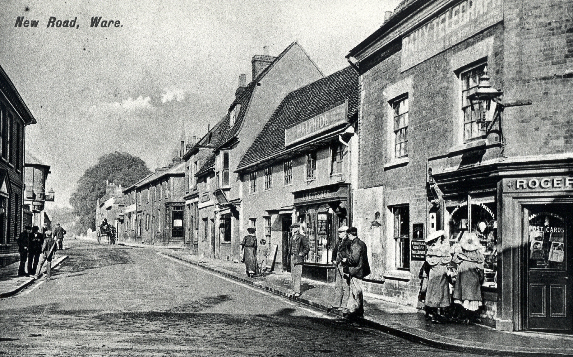
New Road - looking towards The Town (HALS ref: DE/X1025/2/92/10)
Hertfordshire Archives and Local Studies
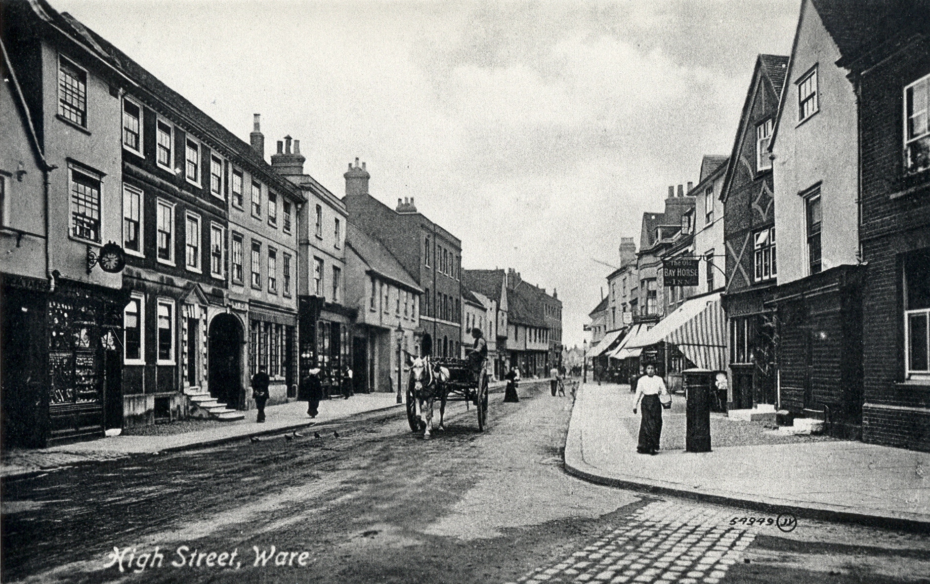
The High Street - from New Road (HALS ref: DE/X1025/2/92/40)
Hertfordshire Archives and Local Studies
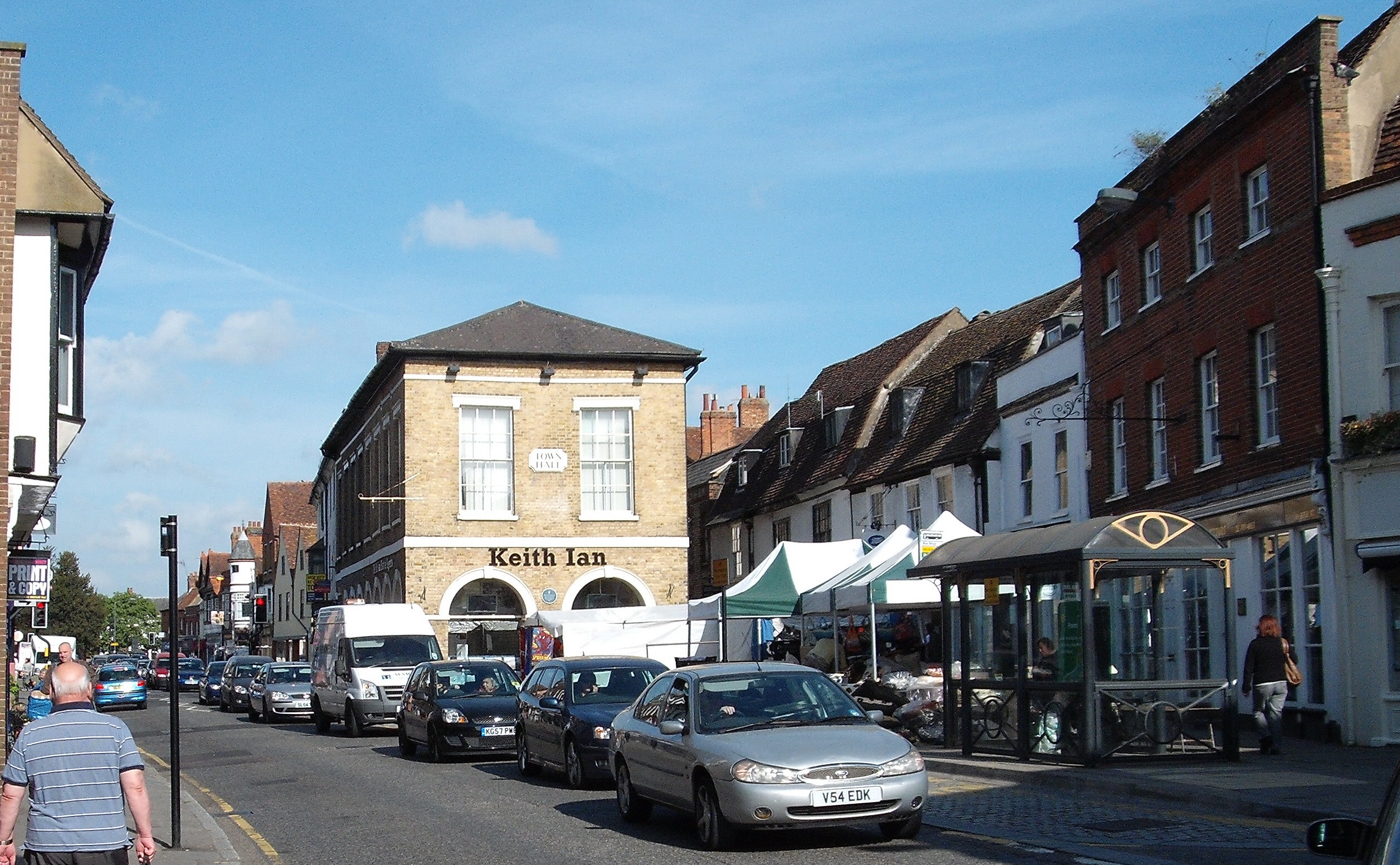
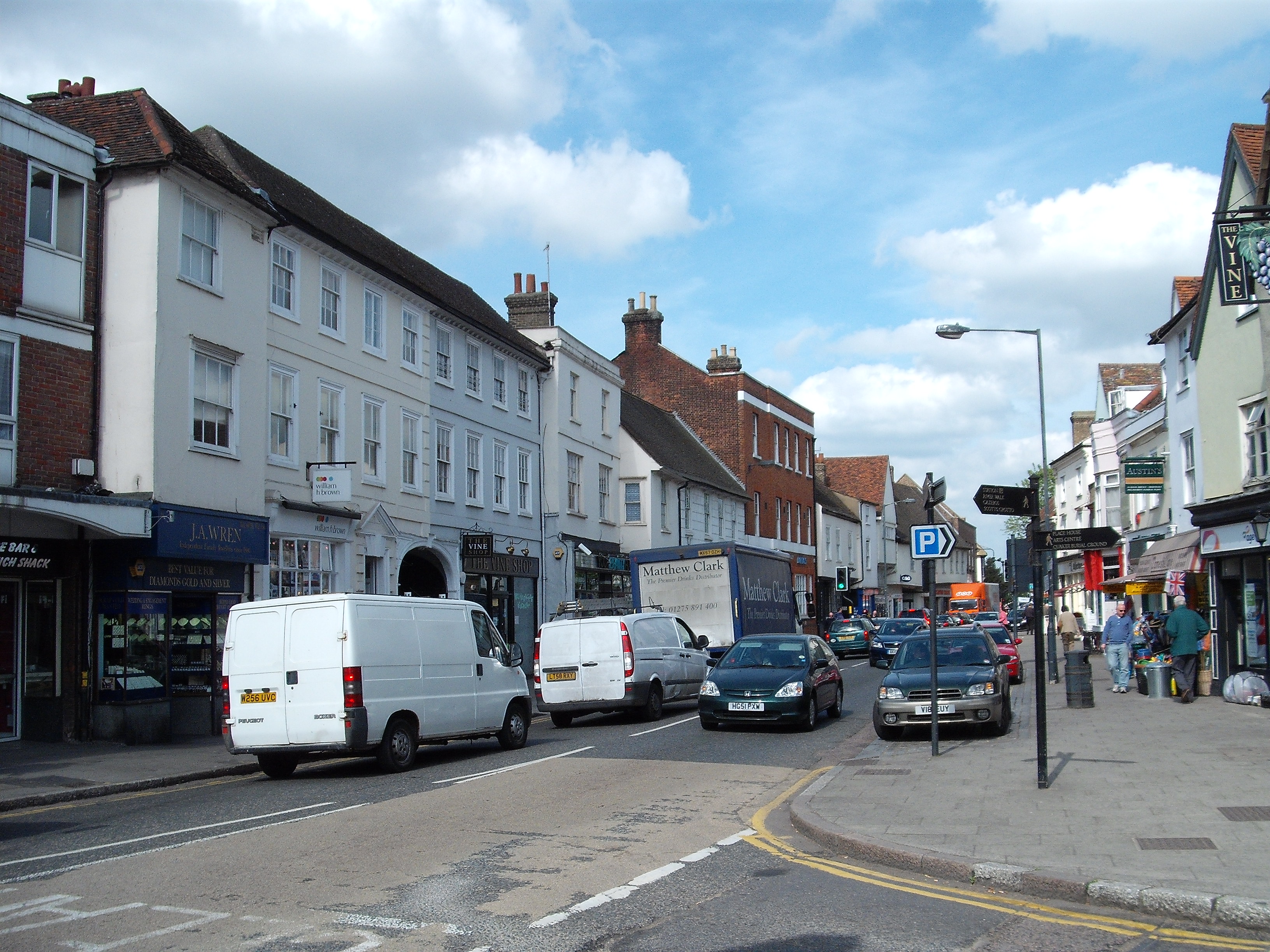
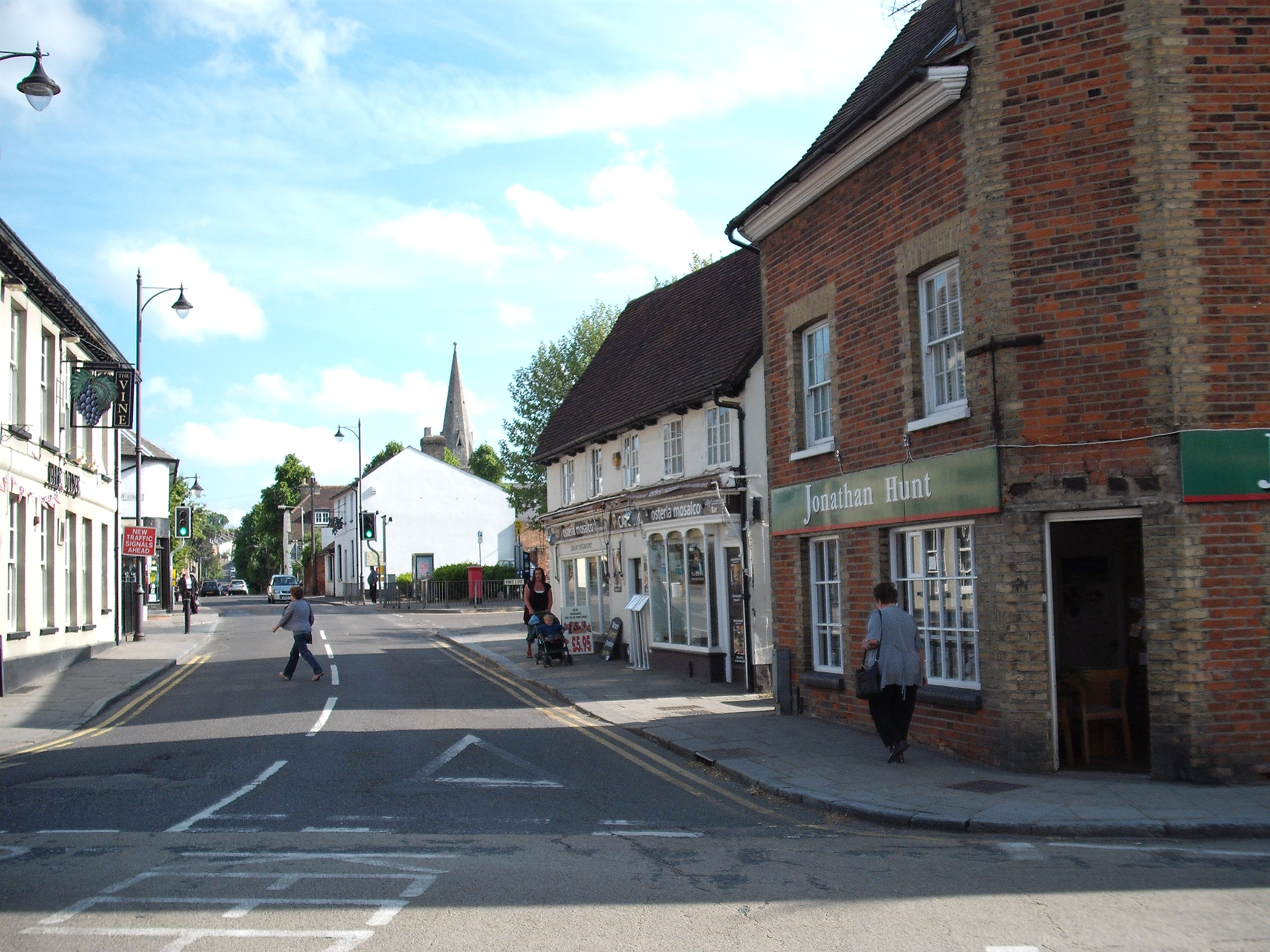
The High Street in 2011
Terry Askew
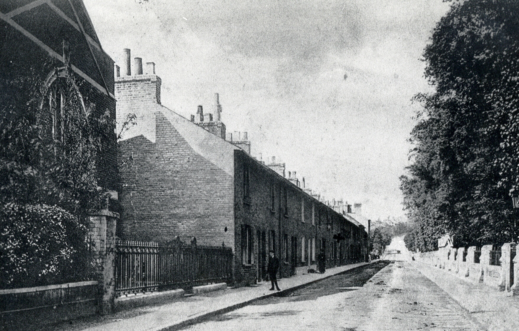
New Road - showing buildings to the right now gone
Hertfordshire Archives and Local Studies
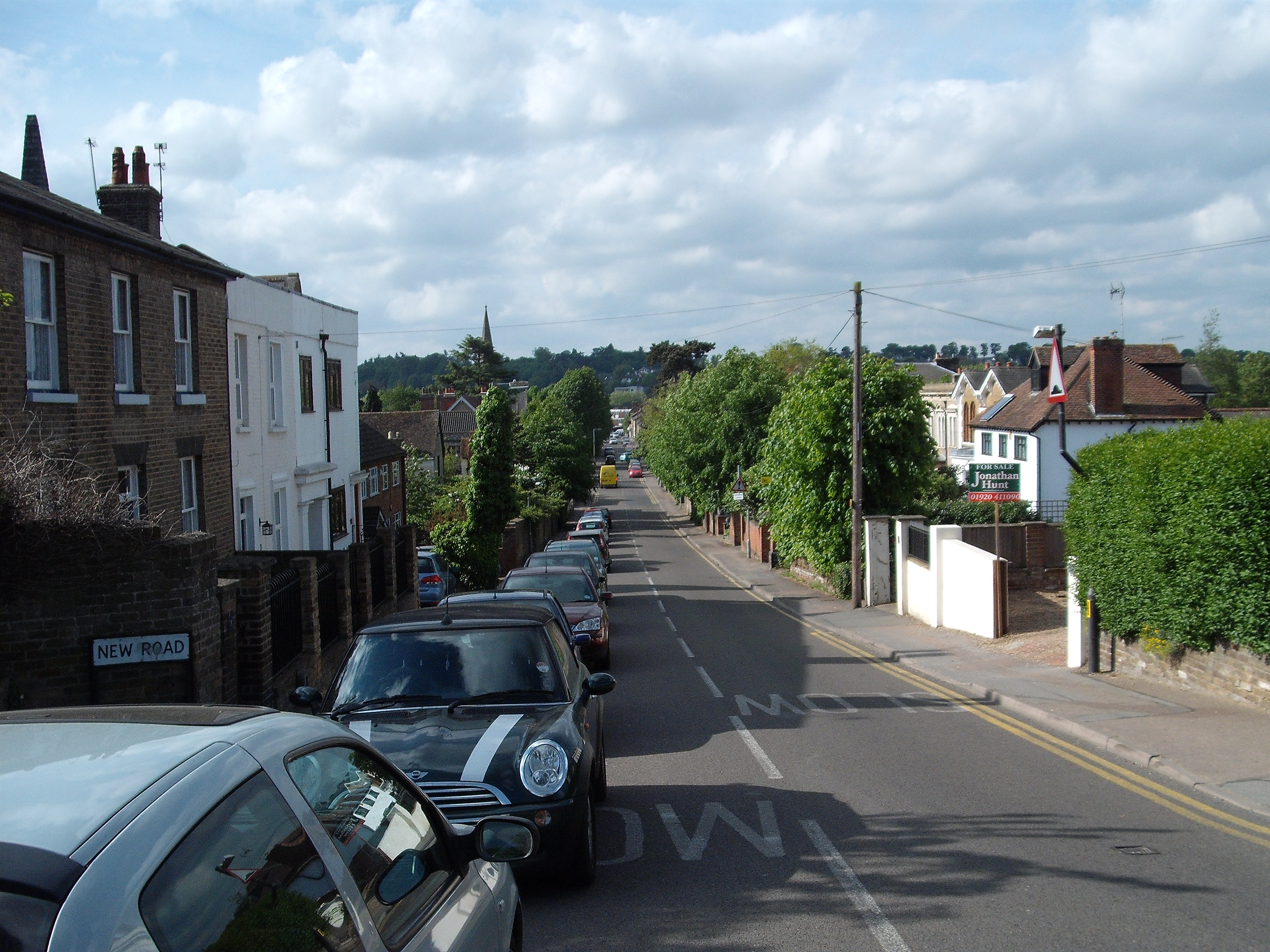
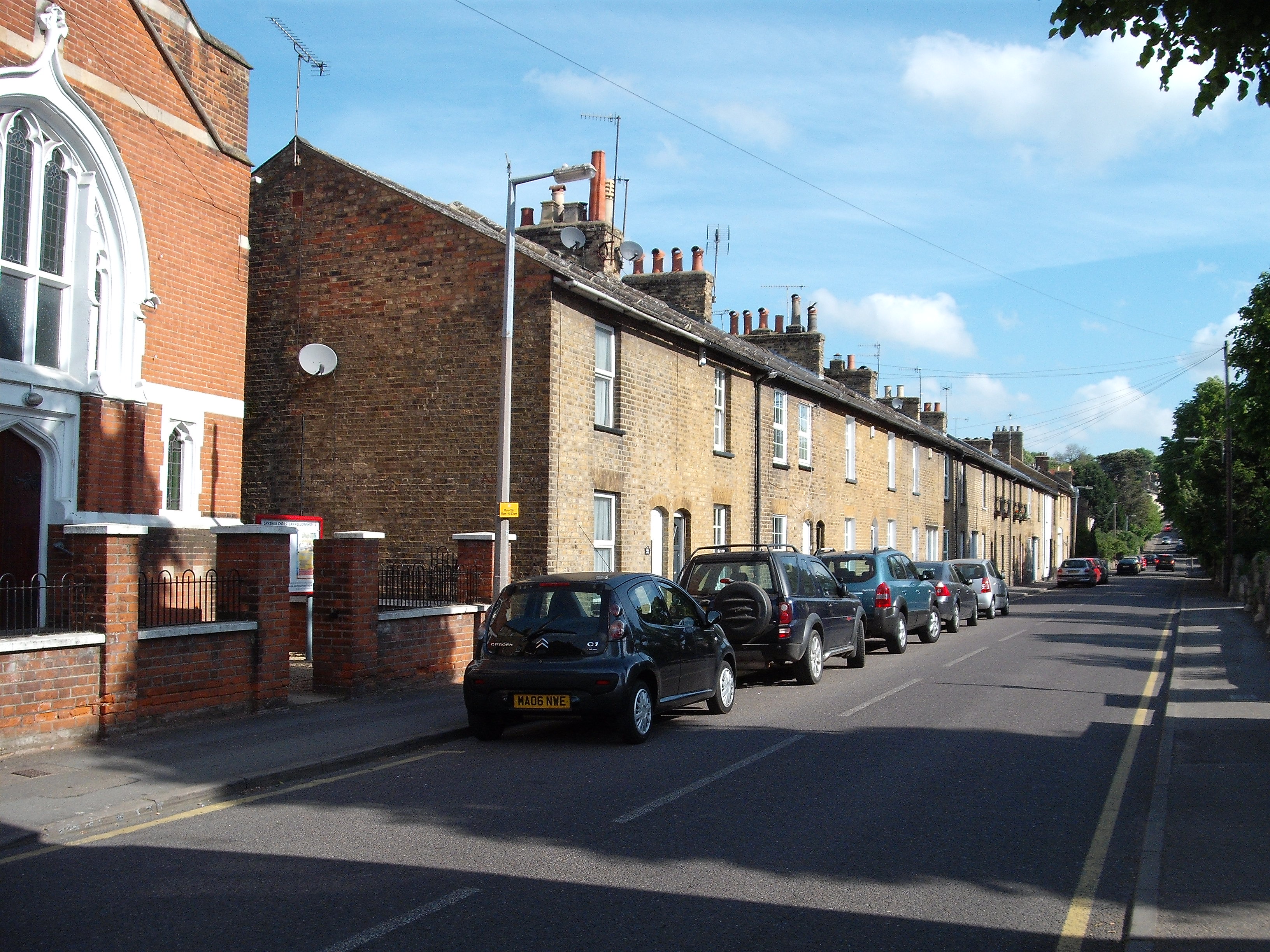
New Road in 2011
Terry Askew
New Road - going up the hill
Hertfordshire Archives and Local Studies
New Road - from The Town (HALS ref: DE/X1025/2/92/12)
Hertfordshire Archives and Local Studies
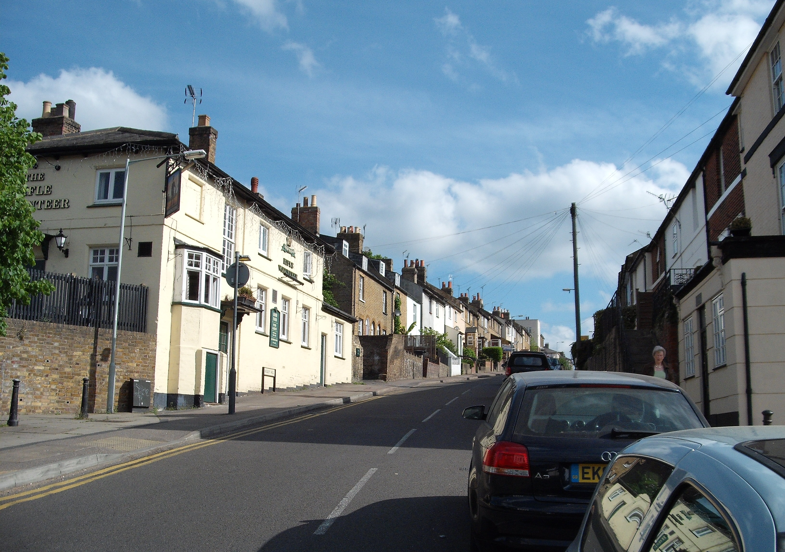
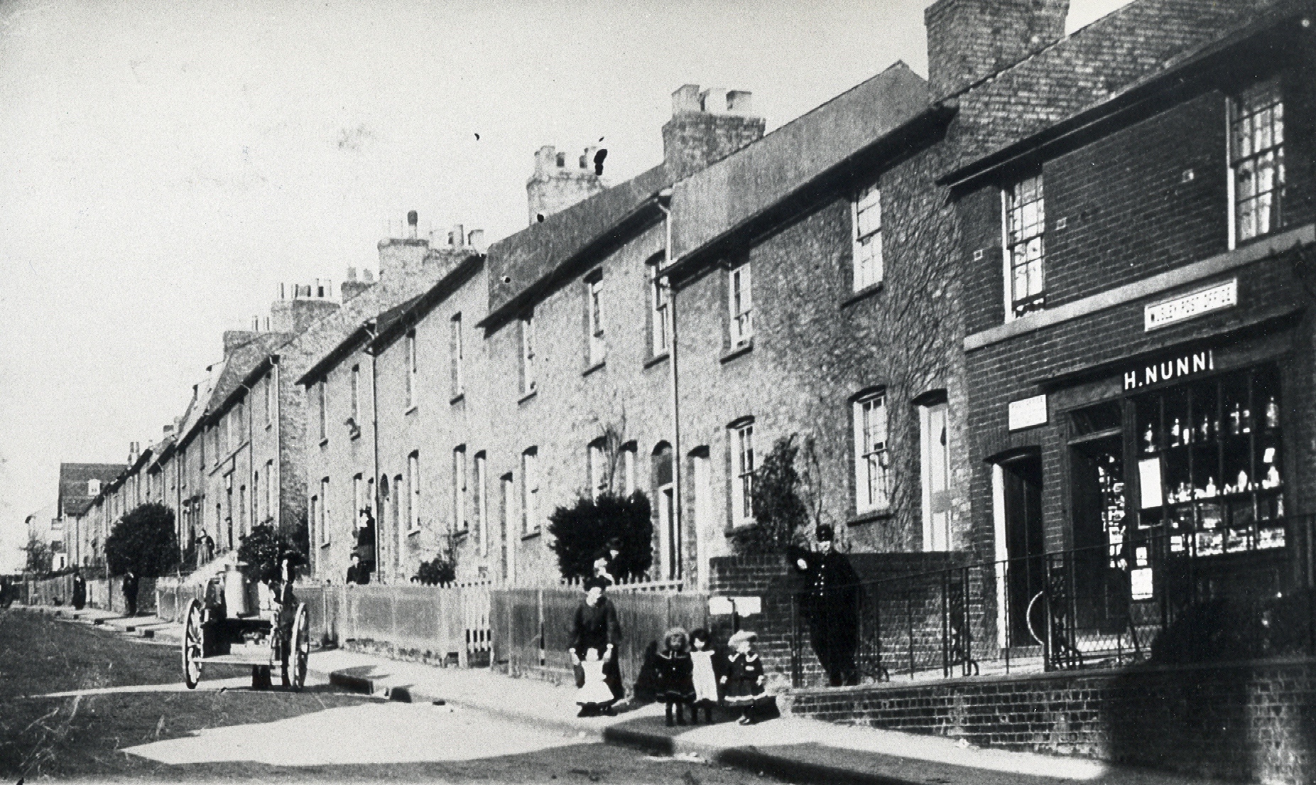
The Rifle Volunteer - Musley Hill
Hertfordshire Archives and Local Studies
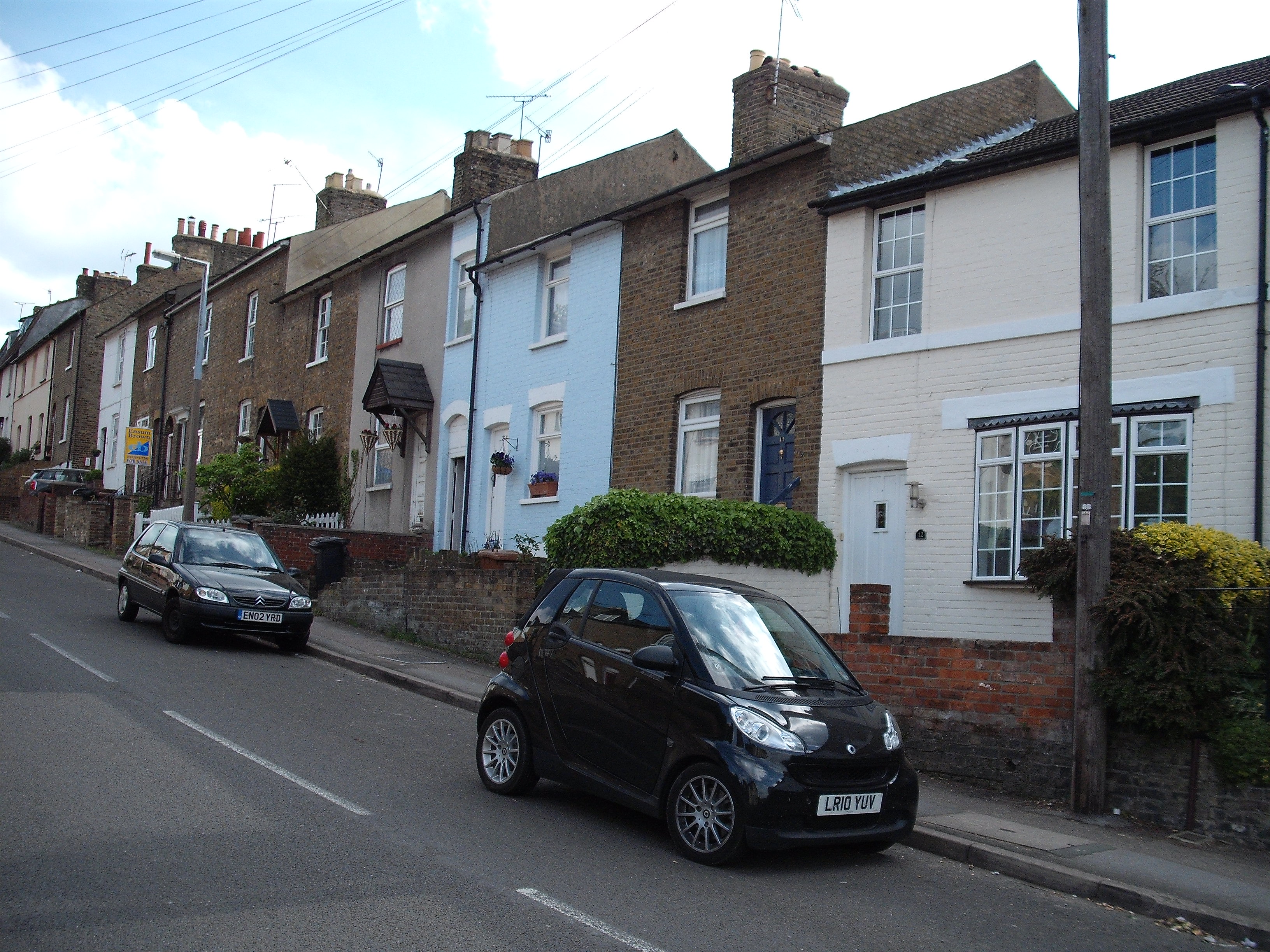
Musley Hill 2011
Terry Askew
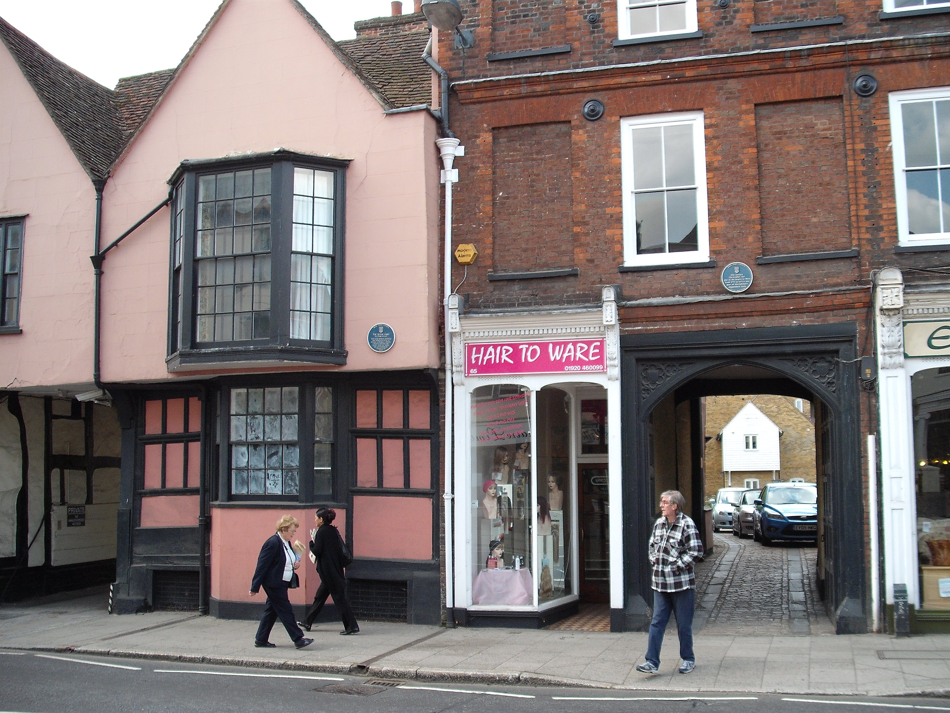
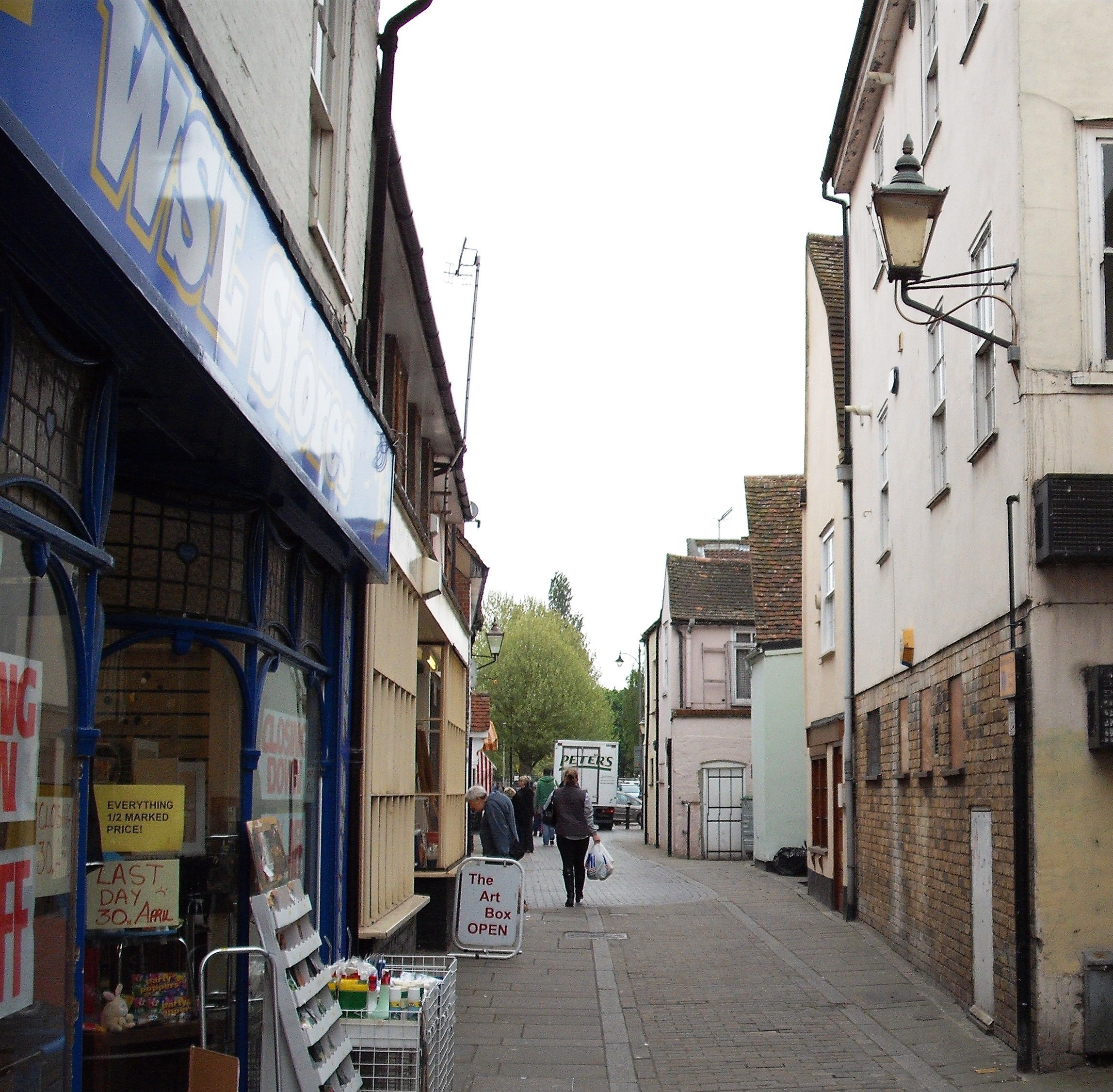
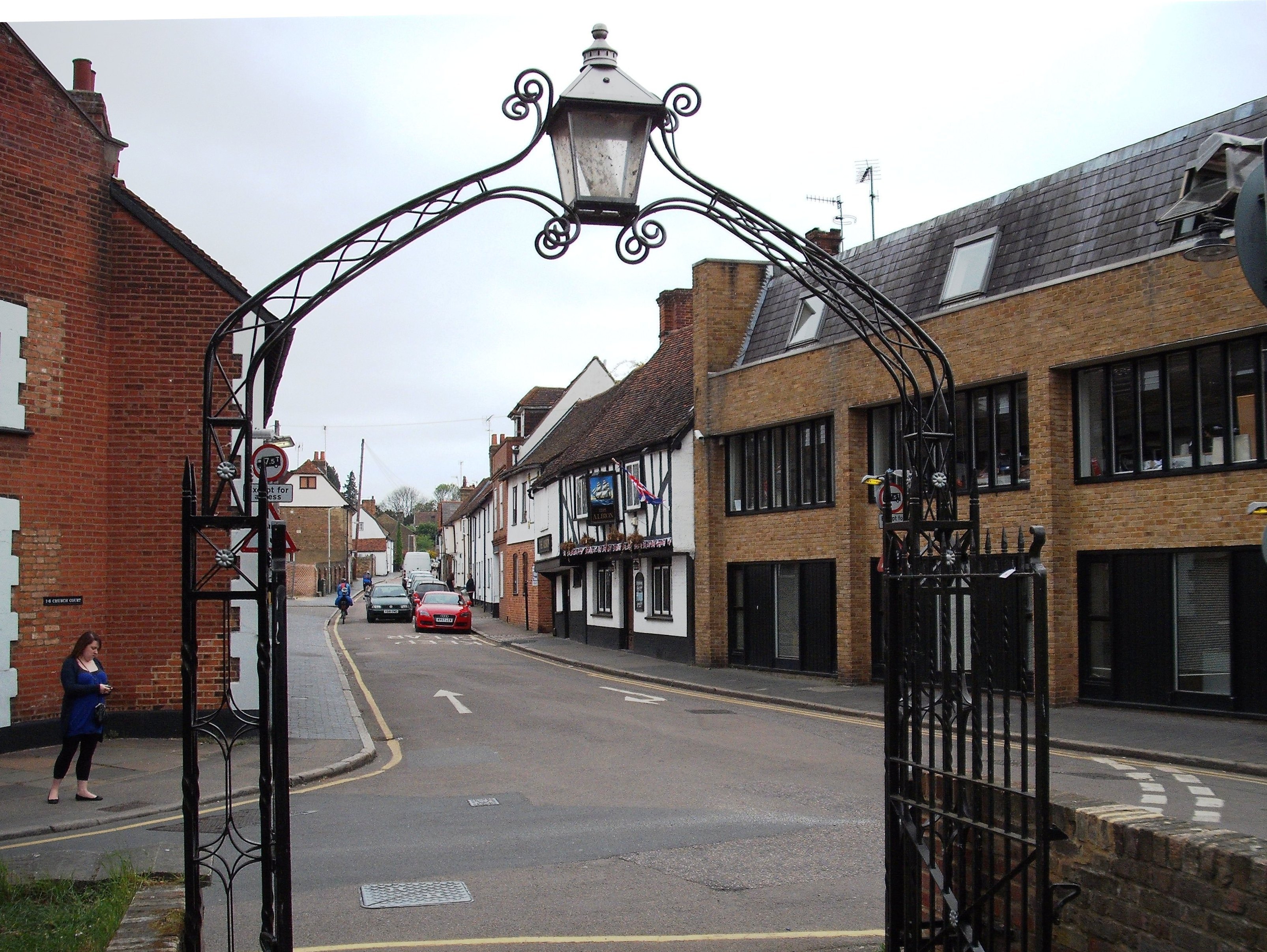
Shop and arch in the High Street
Hertfordshire Archives and Local Studies
Shop and arch 2011
Terry Askew
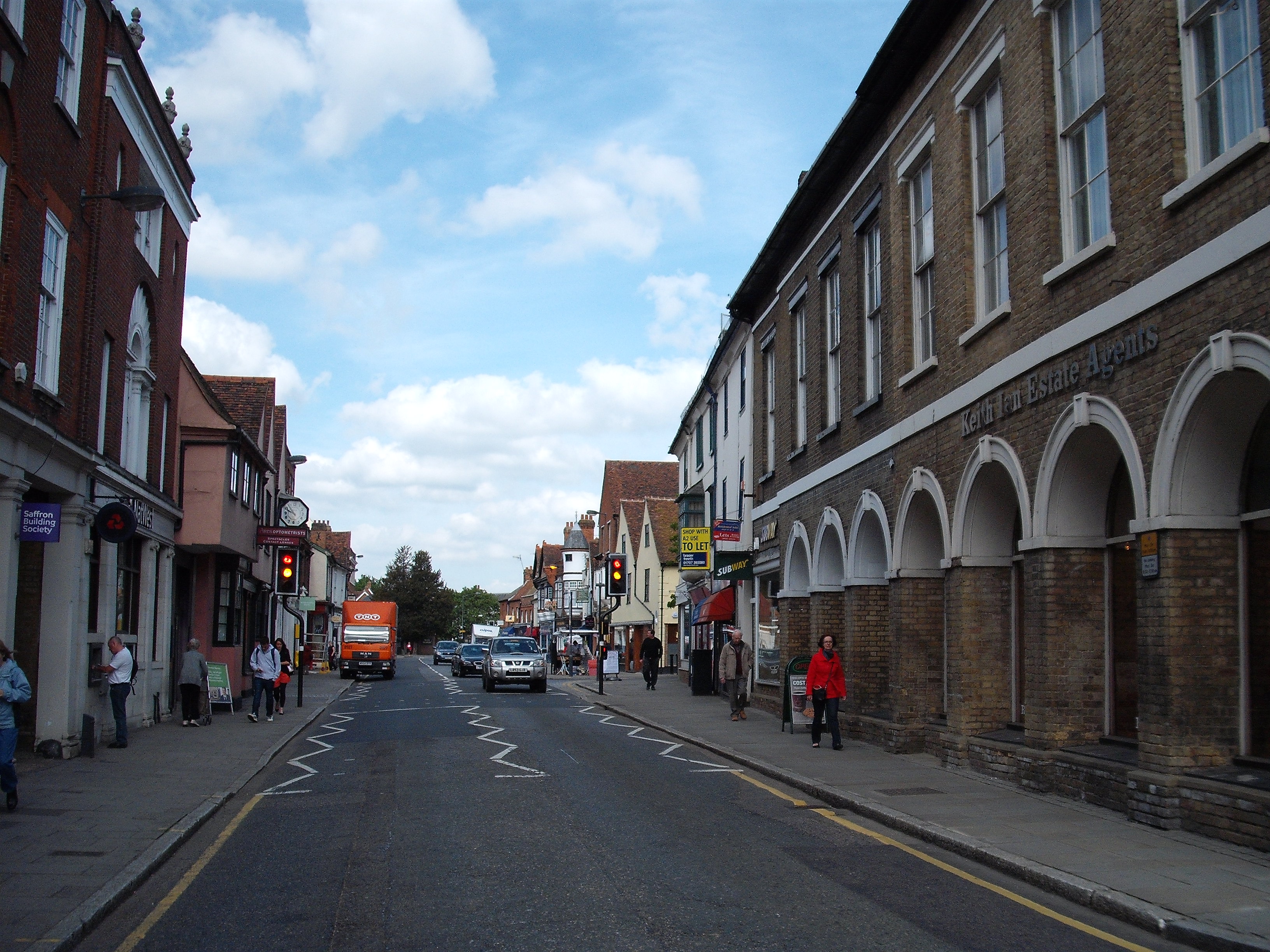
High Street - beside the old Town Hall
Hertfordshire Archives and Local Studies
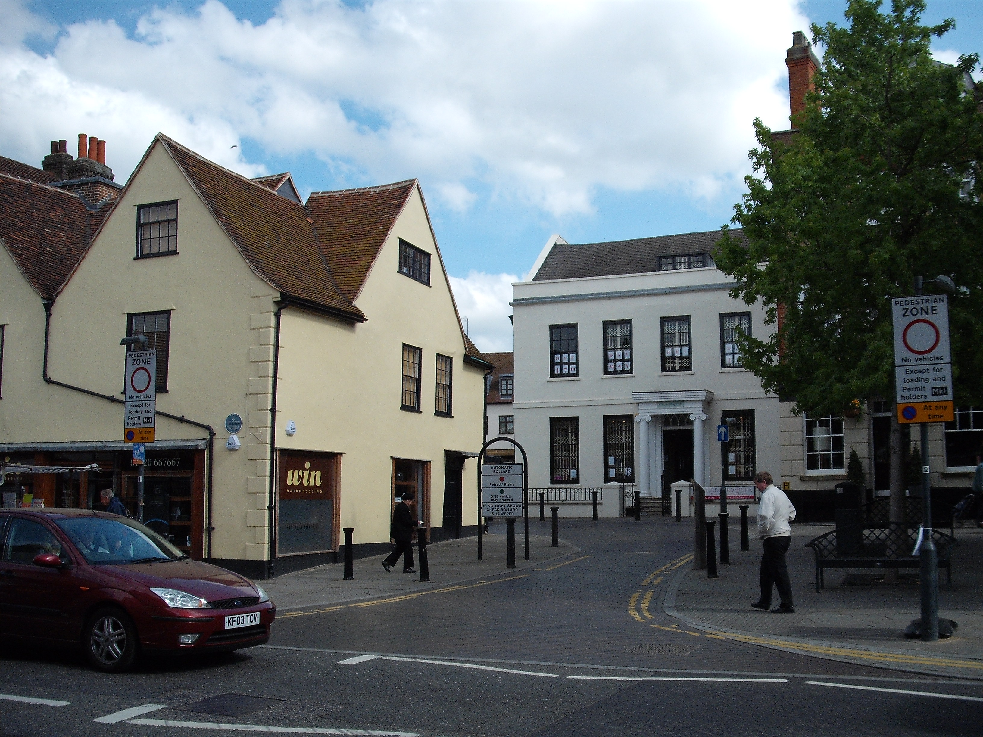
Same view in 2011
Terry Askew
Shop at 12 Musley Hill - now a house
Hertfordshire Archives and Local Studies
Same houses on Musley Hill 2011
Terry Askew
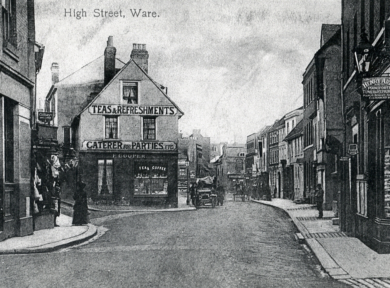
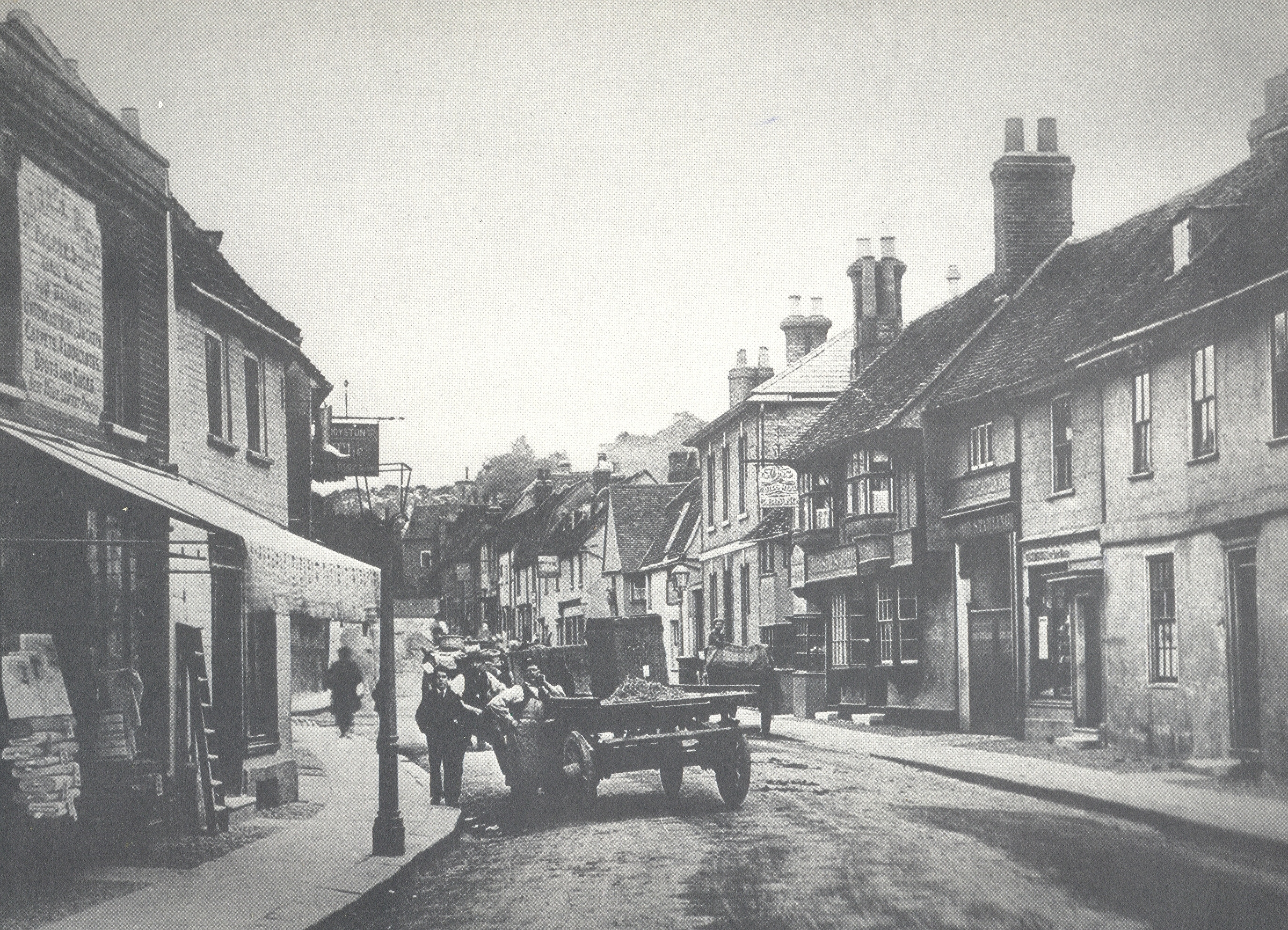
High Street scene
Hertfordshire Archives and Local Studies
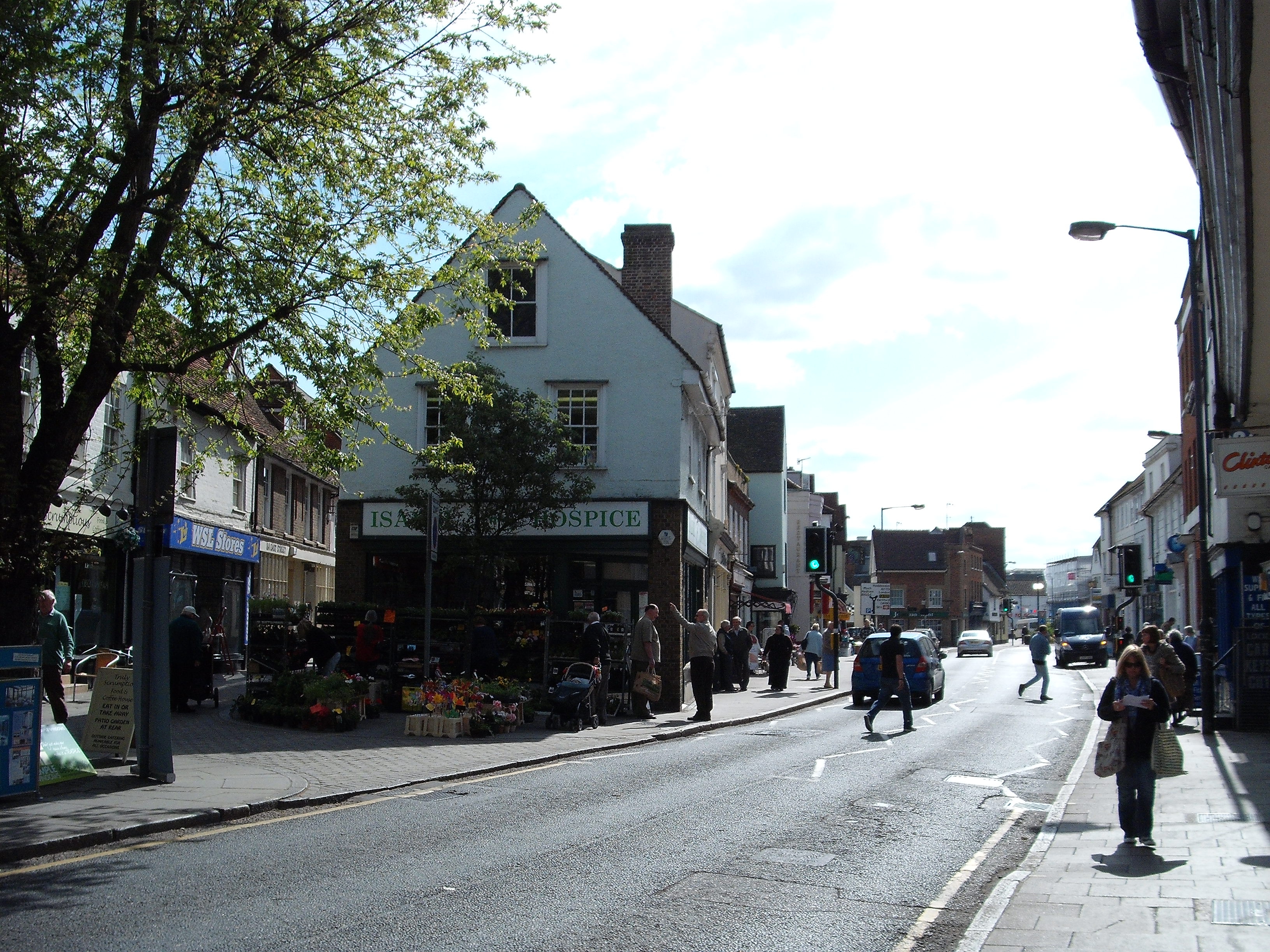
High Street in 2011
Terry Askew
The High Street - looking south (HALS ref: DE/X1025/2/92/41)
Hertfordshire Archives and Local Studies
High Street 2011
Terry Askew
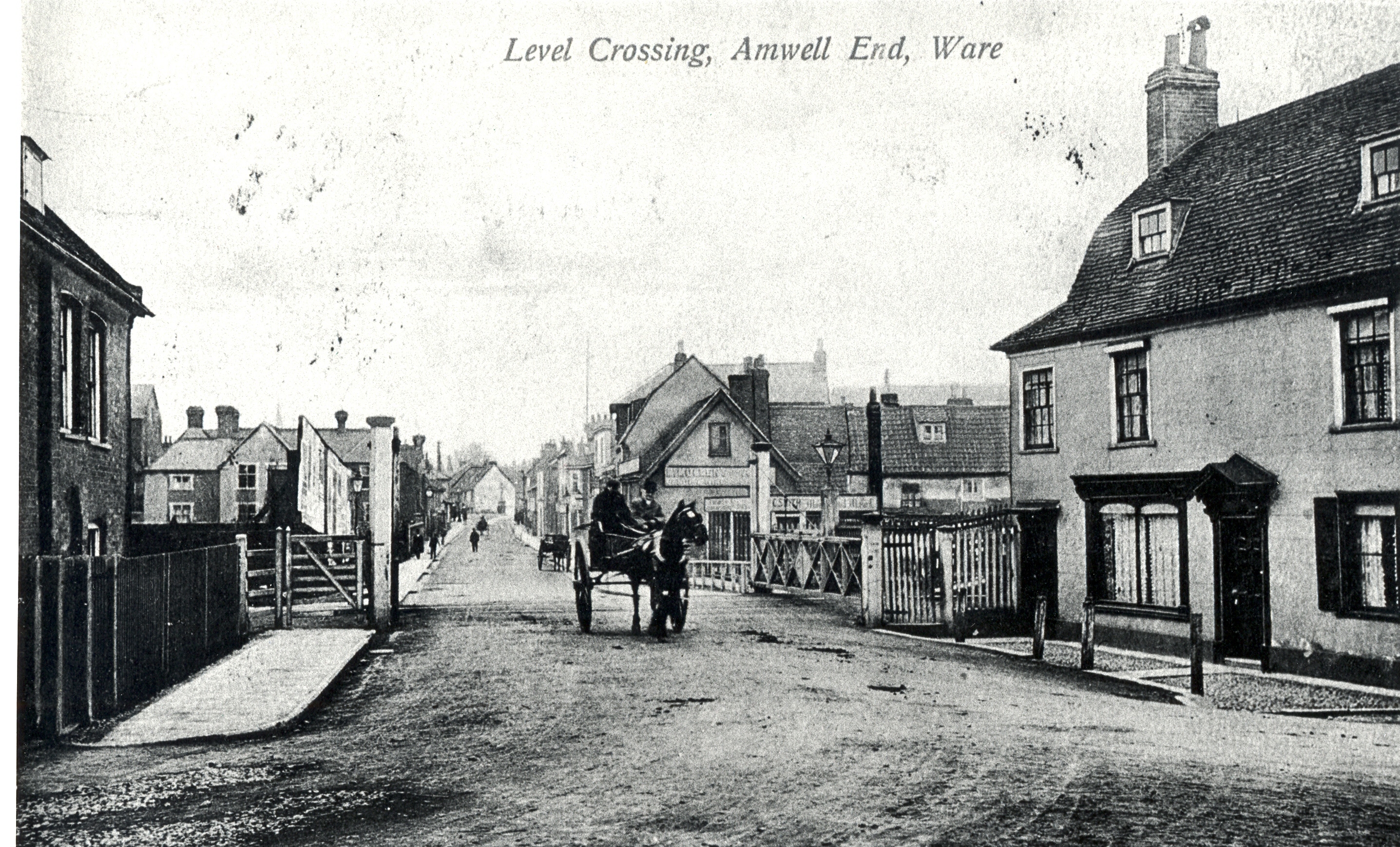
Level crossing - Amwell End (HALS ref: DE/X1025/2/92/43)
Hertfordshire Archives and Local Studies
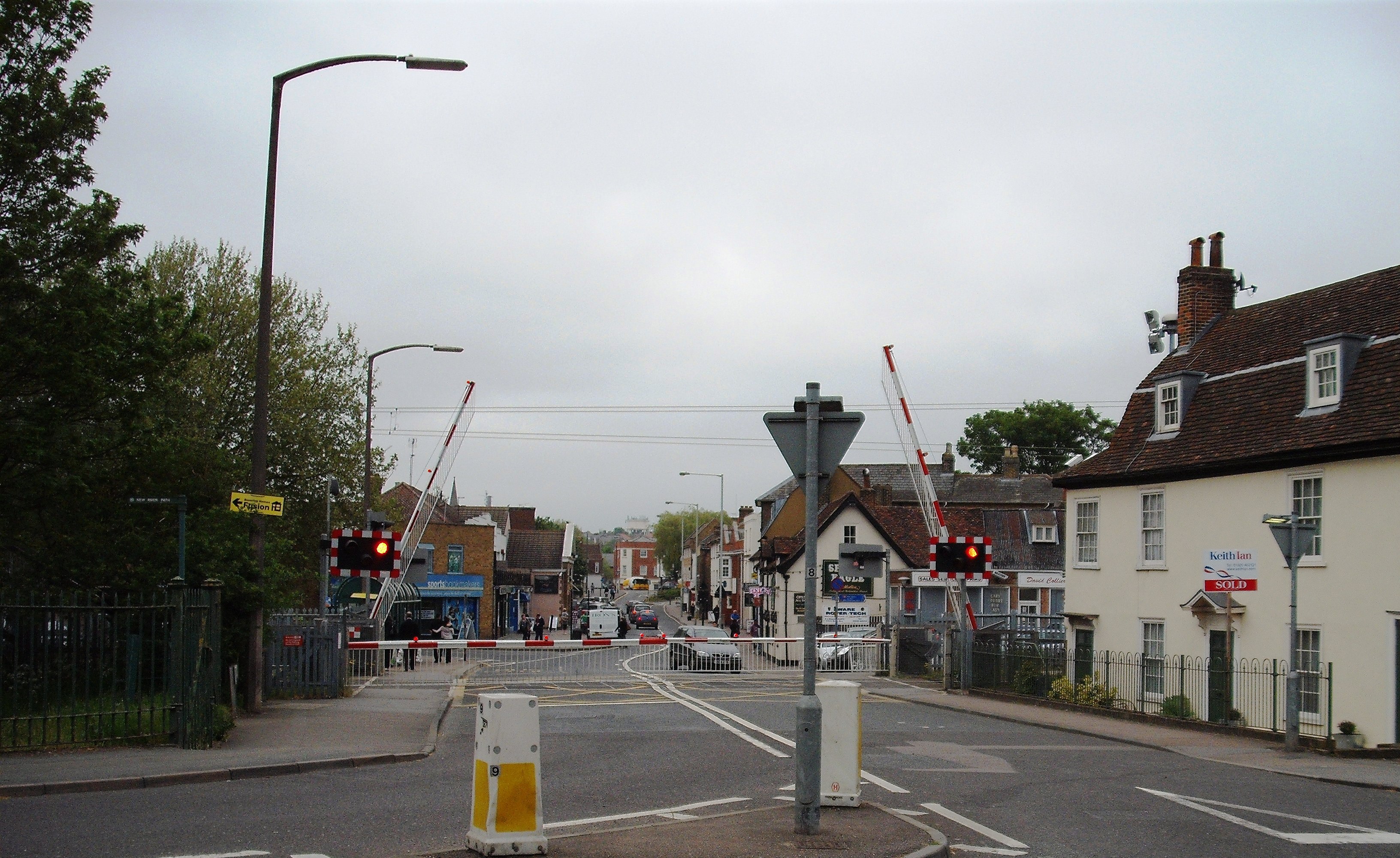
Level crossing - looking towards the Town Centre
Hertfordshire Archives and Local Studies
The same view in 2011
Terry Askew
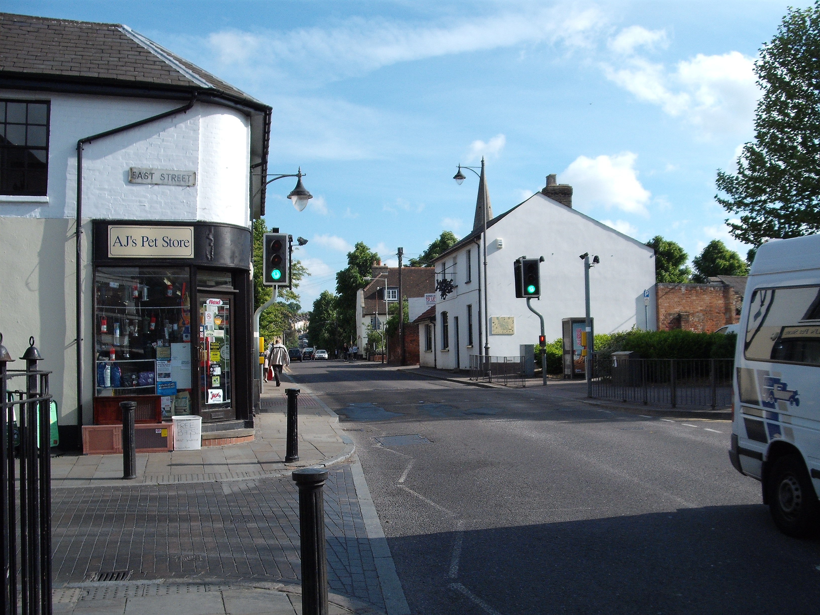
East Street
Hertfordshire Archives and Local Studies
East Street - 2011
Terry Askew
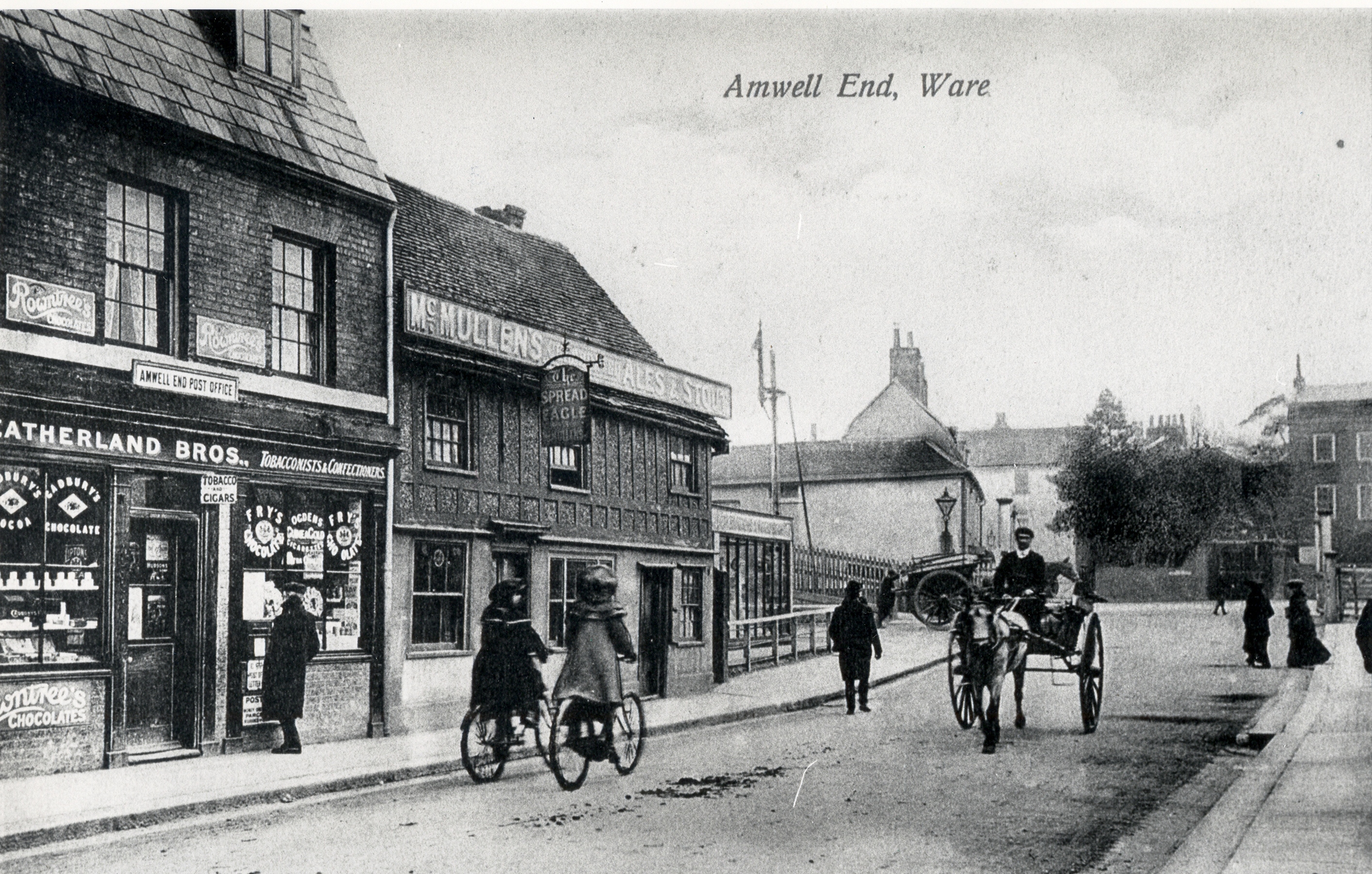
Amwell End - looking towards the railway
Hertfordshire Archives and Local Studies
Amwell End in 2011
Terry Askew
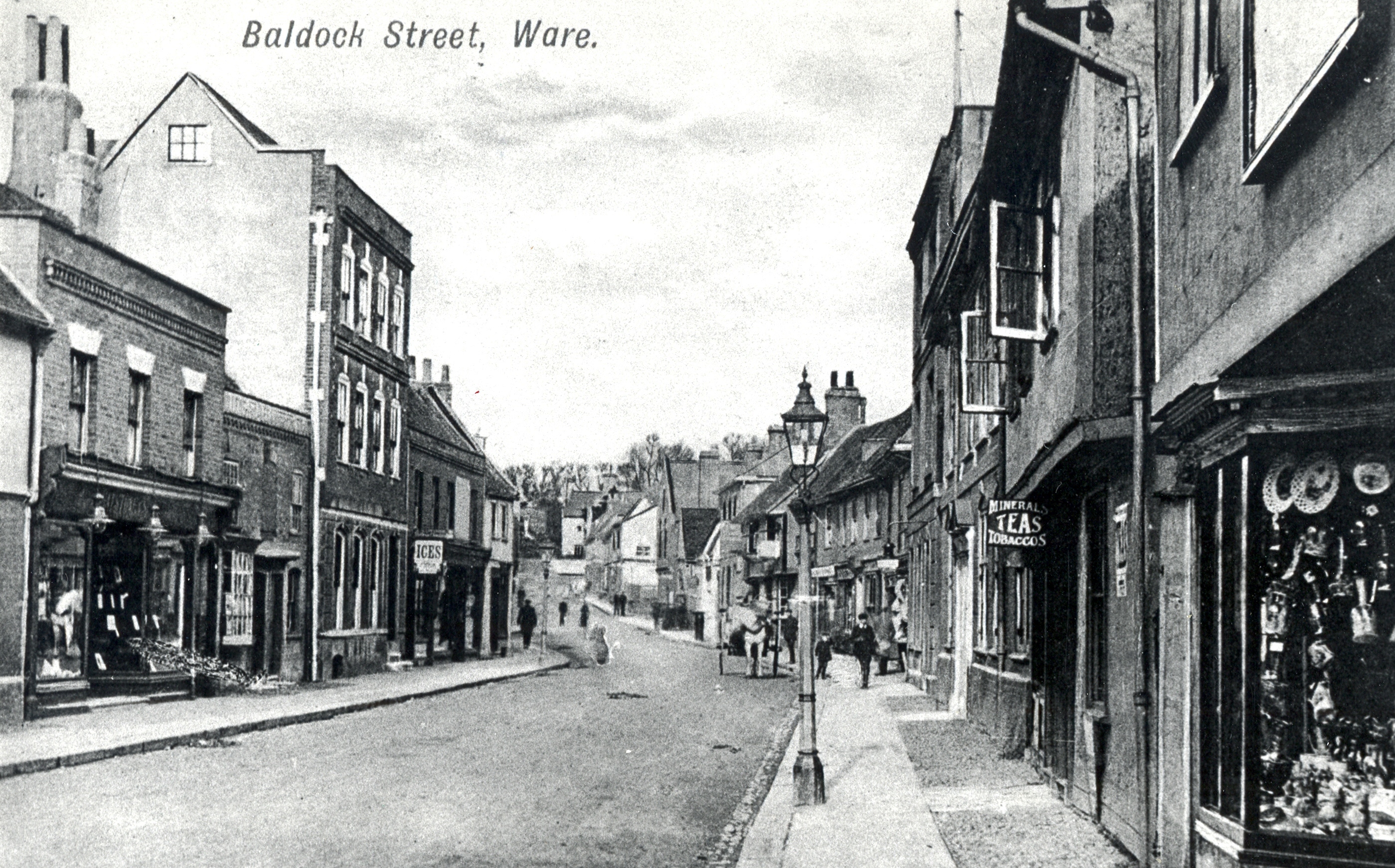
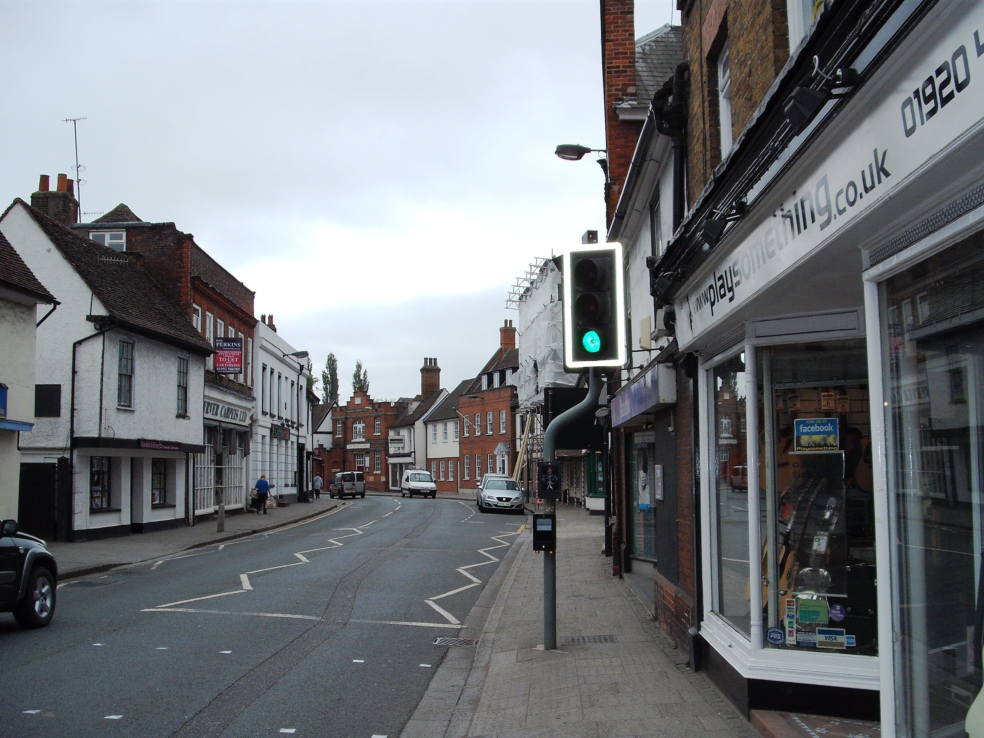
Baldock Street - looking away from the Town Centre (HALS ref: DE/X1025/2/92/33)
Hertfordshire Archives and Local Studies
Baldock Street in 2011
Terry Askew
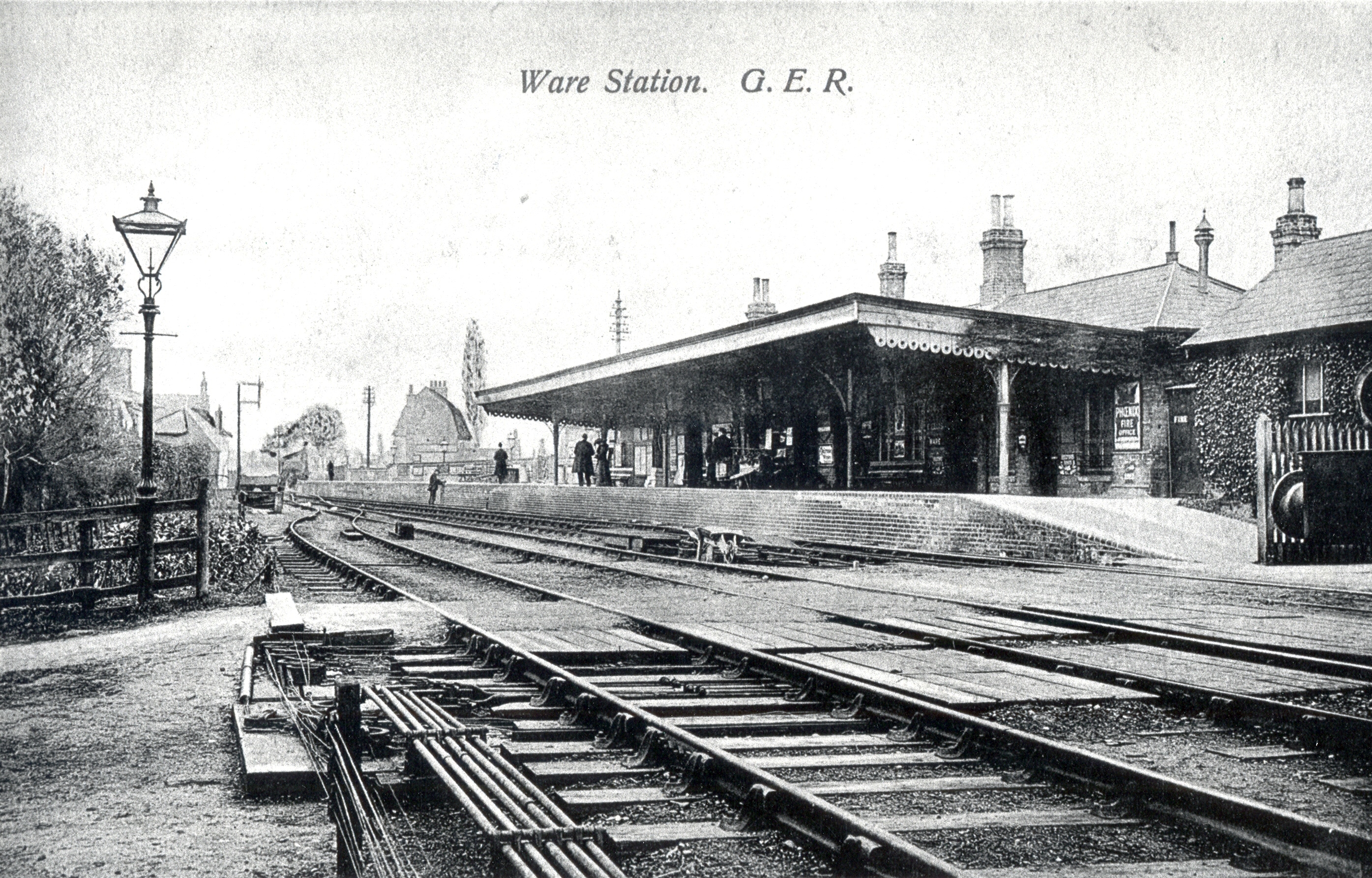
Ware Station - showing the old pedestrian access crossing (HALS ref: DE/X1025/2/92/44)
Hertfordshire Archives and Local Studies
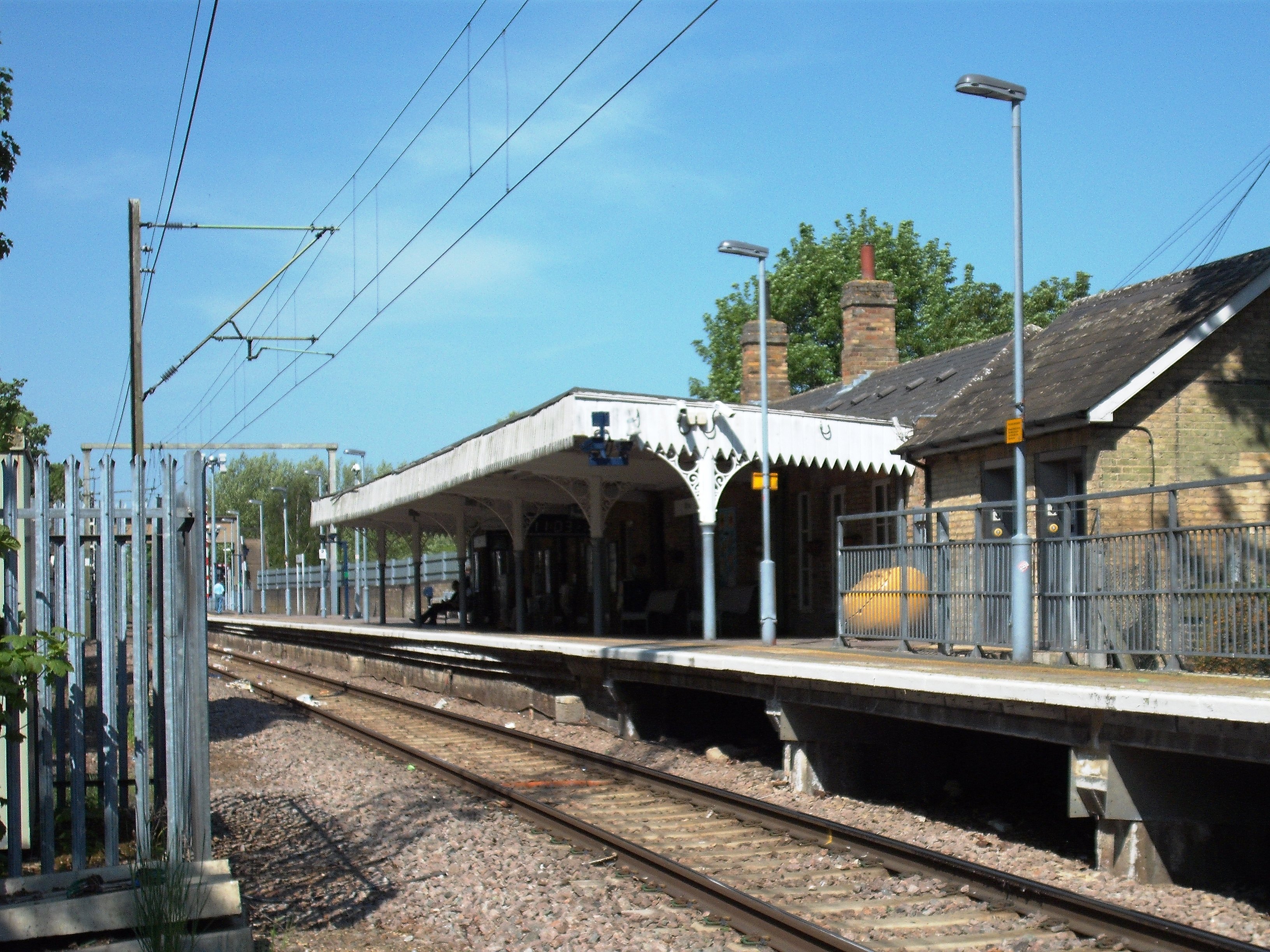
Ware Station from across the line
Terry Askew
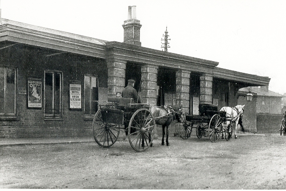
Ware Station - street entrance
Hertfordshire Archives and Local Studies
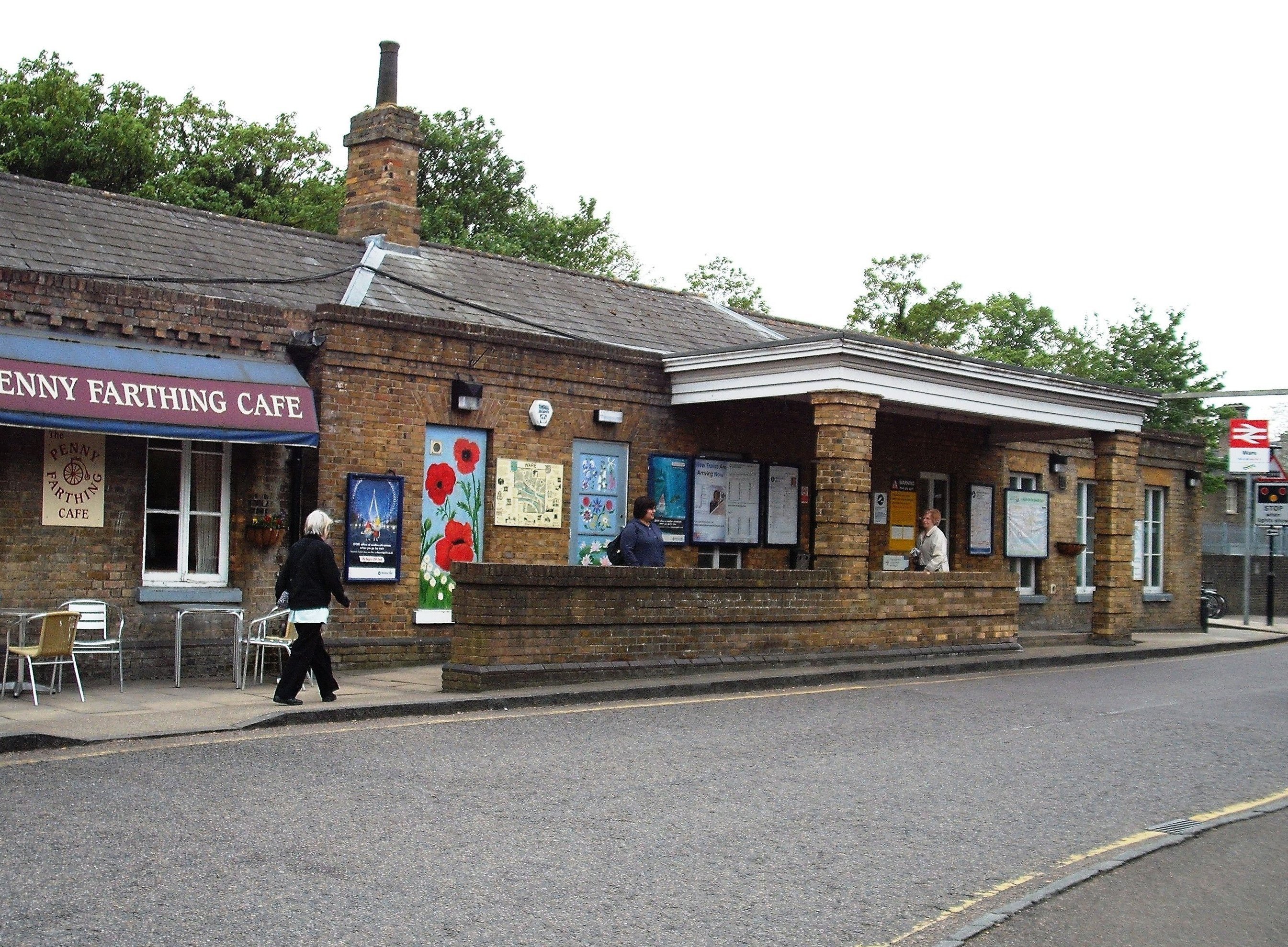
Ware Station 2011
Terry Askew
Ware Priory - from the river (HALS ref: DE/X1025/1/116/5)
Hertfordshire Archives and Local Studies
Ware Priory 2011
Terry Askew
Baldock Street - looking north towards Watton Road
Hertfordshire Archives and Local Studies
Baldock Street - 2011
Terry Askew
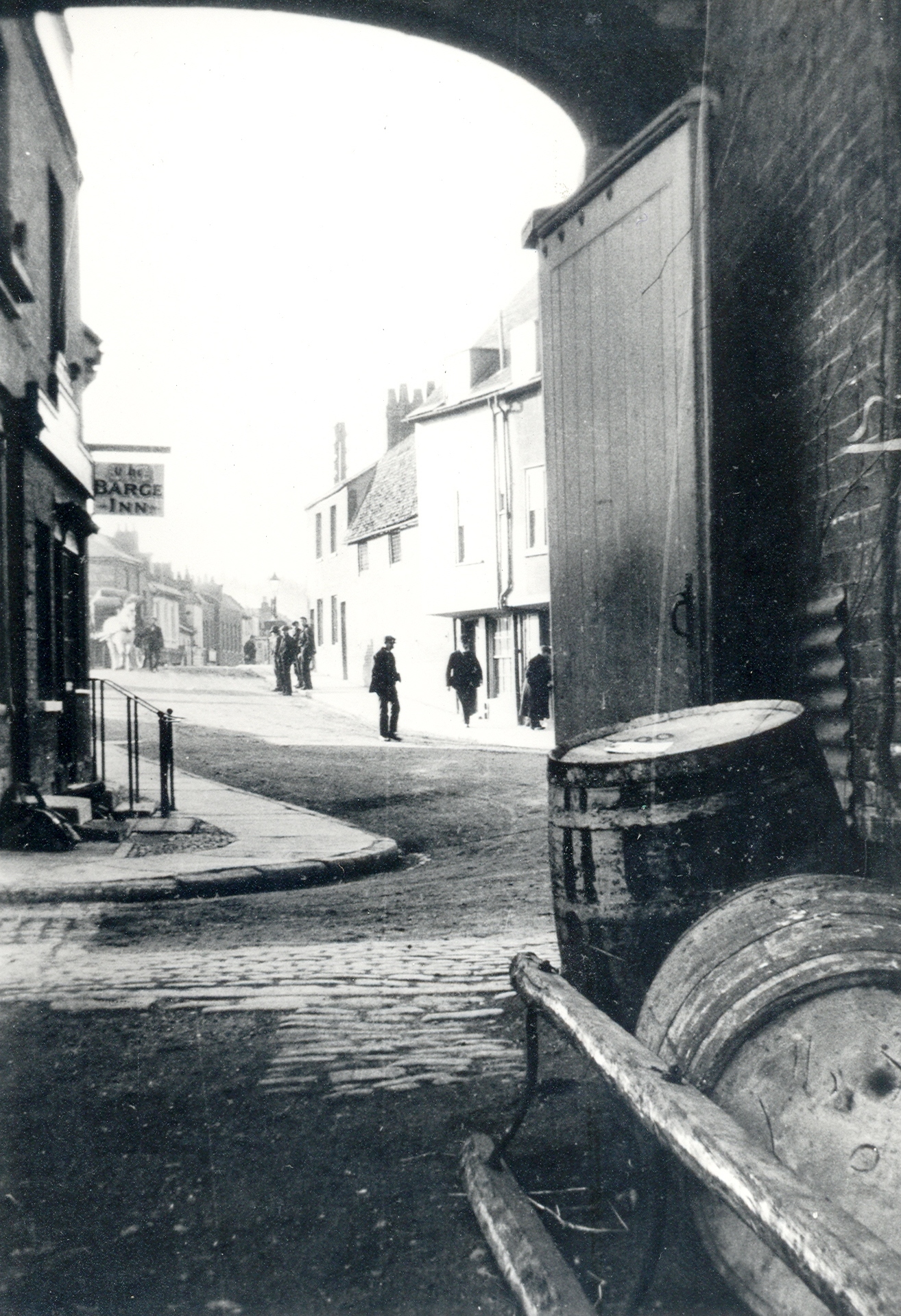
View through an archway of the old Barge Inn - now replaced by the 'Navigator' and archway now gone
Hertfordshire Archives and Local Studies
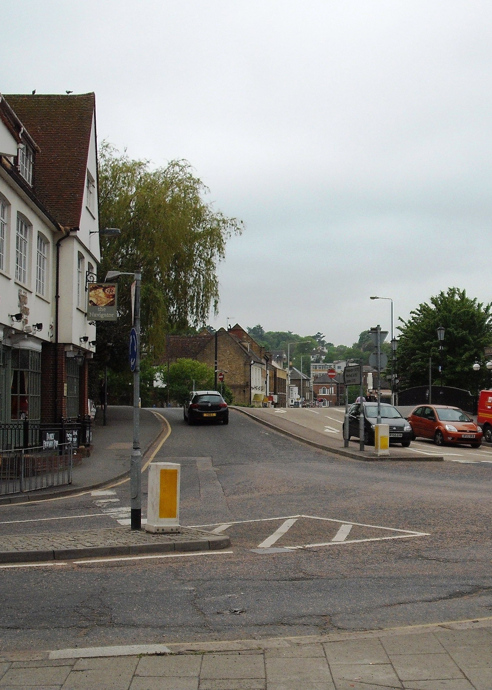
Site of archway and Barge Inn now Navigator
Terry Askew
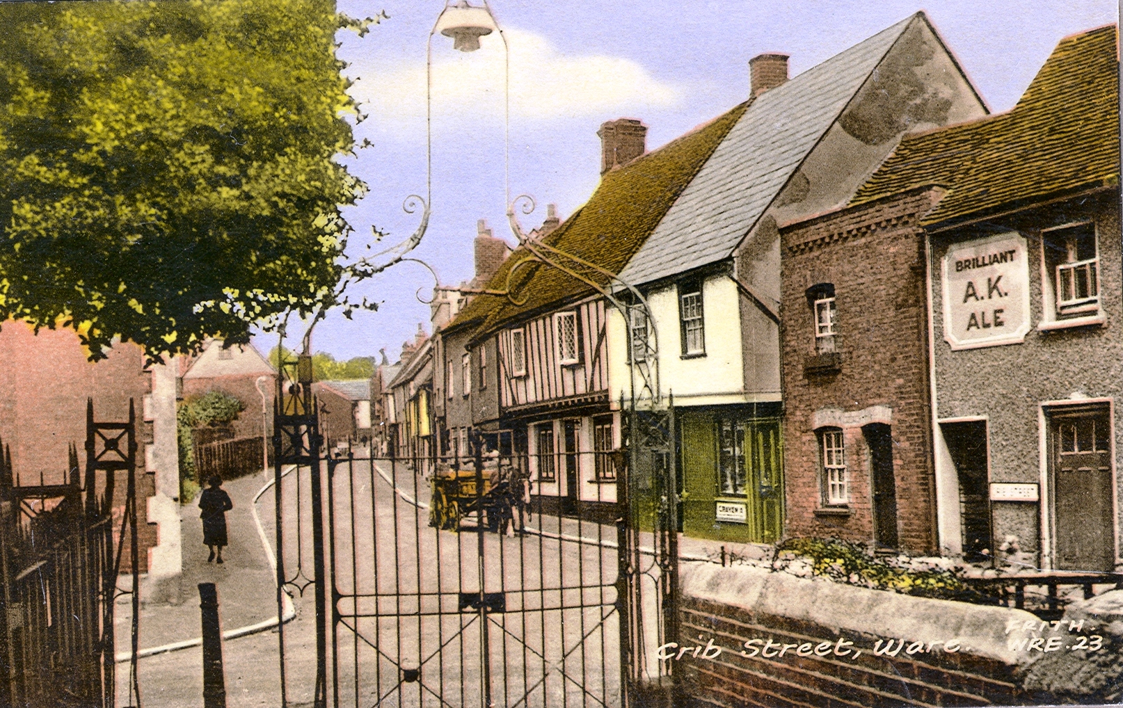
Cribbs Lane - from the churchyard, showing buildings since replaced
Hertfordshire Archives and Local Studies
Cribbs Lane 2011
Terry Askew
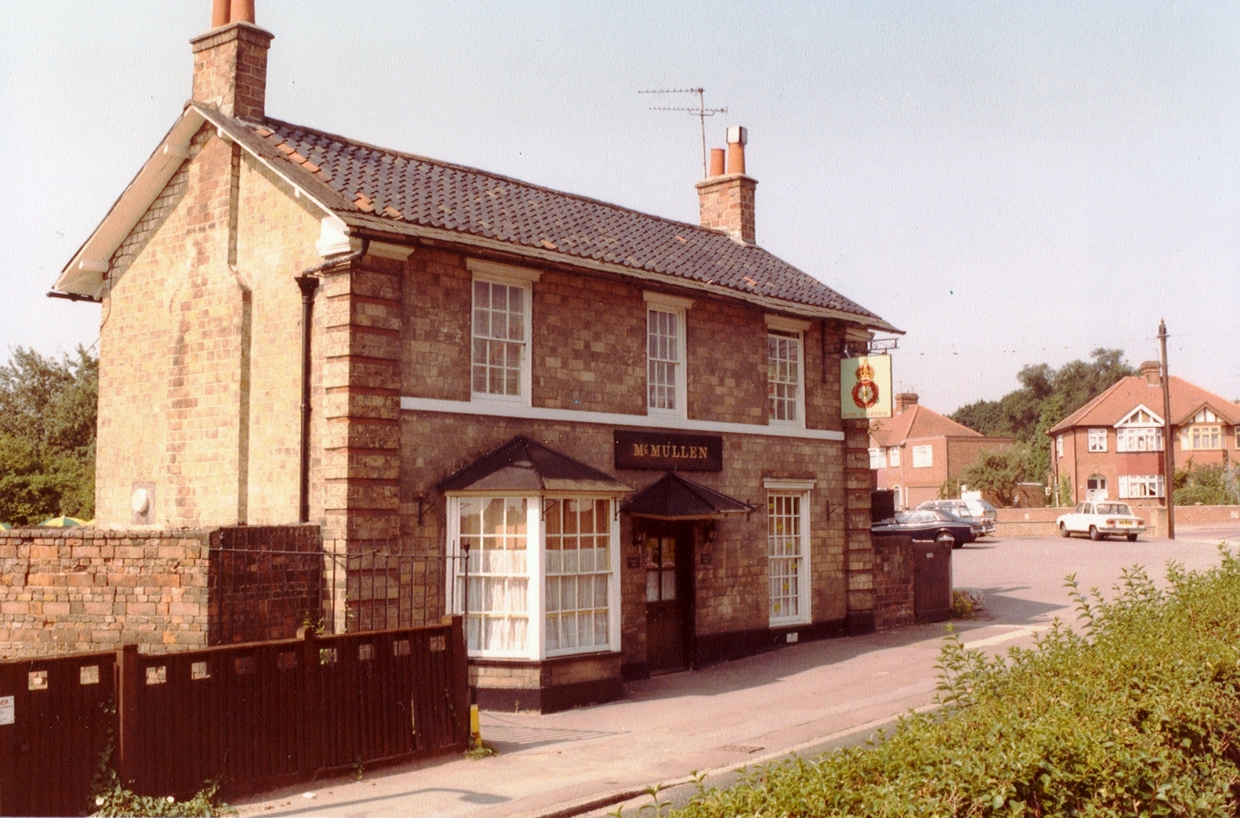
Rose and Crown - Watton Road in 1965
Hertfordshire Archives and Local Studies
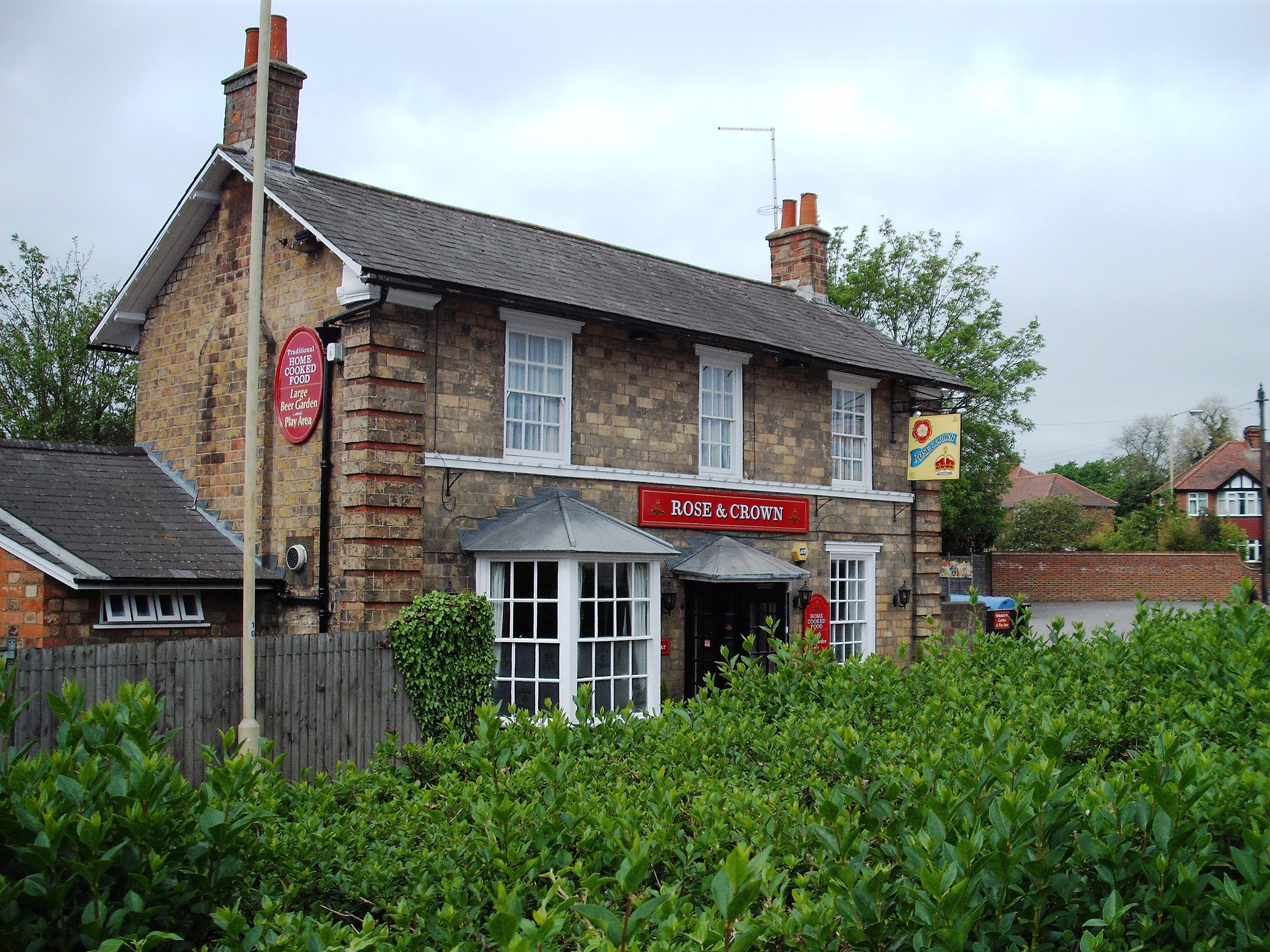
Rose and Crown in 2011 - hardly changed
Terry Askew
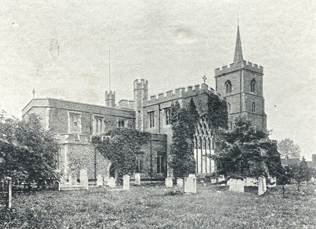
Parish Church of St. Mary - since surrounded by trees
Hertfordshire Archives and Local Studies
St. Mary's through the trees
Terry Askew
This page was added on 11/05/2011.


Add your comment about this page
Does anyone remember a frozen food company called Fropax, which had a factory for frozen food packages and canning facilities in Ware, on the edge of the town? I worked there for two summers in 1962 and 1963 when I was a college student
Hugh McF
Amazing that so many buildings haven’t changed much – spesh high street highly recognizable.
Relatives on my Mothers side are from Ware. Surname of Hammond. Some ran the Cherry Tree Inn on Amwell End. Others are listed as working as Bargemen and Watermen in Ware.
My husband’s great grandfather’s family lived in Amwell end and he is planning a trip to Ware soon – are there any local historians he could meet up with?
Wonderful before and after photographs, The Malabo Ph was where the John Gilpin was almost next door to the 2 cottages to the right of Gilpin Road, it used to have a tall wall to the right of it with a post box in the wall, a wall we used to climb over to the fields behind.
My Grandmother and her sister both worked for The Devitts at Great Cozzens House in the mid 1910*s, I would love to have any information on the house during that period.
Some of my ancestors had the Malakoff beer house in London rd, from abt 1880 to somewhere abt 1915/7. I have tried to find exactly where it was located ( believe it may be a private house now) and any pictures of same.
Building that is Byrver carpet shop seems to have lost the top floor??
I Lived at number 2 church street and remember mrs pinchin where i used to go to get the accumallorchar it was a very small shop but was well used
We lived at 28 crib st. In 1952-54. Mrs. Pinchin had a little grocery shop next to a pub just down the street. My husband worked at the Northmet, and I worked at Allen & Hamburg’s. Many fond memories of those days. Loved the pictures of Ware. Helen (Pope)
As the author of the article agrees, I have changed the title on the Baldock Street image.
Baldock Street – looking towards the Town Centre
Agree with the earlier comment that this picture is mis-labelled. The view is towards Thunder Hall which can be seen in the far distance on the right. Also the road is sloping upwards as it still does.
A contributor to this website is currently researching a former old house called Musley Lodge located on High Oak Road in Ware nr. the Junction with Redan Road that was demolished around 1972-73 to make way for a block of 6 split level terrace town houses currently numbered from 119-129. His family currently lives in one of these 6 terrace town houses for the past 45 years and he was told about Musley Lodge from the builder.
He hasn’t really had any success in finding a photo of Musley Lodge at the archives at County Hall or Ware musuem and there are no old photos of the High Oak Road area in any books on Ware. The closest he has seen an image of Musley Lodge was in two aerial photos of Ware taken in 1949 from the “Britain from Above” website (image EAW022402 and EAW022367) when he registed with the site and zooming in.
What he did find out in his research of this house is that it used to be called Collett Hall Lodge in the early 20th century and was part of the Collett Hall Estate that included what is now the Bourne Park now owned by the council. A private road or track used to run through the estate from the opposite end of Crib Steet and exit High Oak Road, where roughly house no 127 High Oak Road is now located.
He heard that David J. Parker (who used to be a local football referee) and his family lived in Musley Lodge from at least the 1950’s to the mid 1960’s. From then on Micheal F. Staples and his family lived there to at least 1971.
He would be very grateful if any of the living relatives of these familes that he mentioned above that lived in Musley Lodge or any anyone else that lived near the area before 1972 would be able to please submit a photo or photos of this house to hals.enquiries@hertfordshire.gov.uk. It would be nice to see what the area looked like in a photo in the past.
The contributor hopes to hear from someone soon.
Many thanks,
Editorial Team
Hi John Highet,
You can try looking in the photograph collection at the Local Studies library at HALS (Hertfordshire Archives and Local Studies) in the registary block at County Hall.
Great photos– fascinating to see the differences over time! I live on the south bank of the Lea at Crane Mead.(Originally Wickams works) Are there any old photos of the North side of the river opposite my place? (Upstream of the weir and now occupied by the Lygean Ave development) ?
Thank you so much for theses wonderful pictures. Many of my ancestors came from here and I recognise the places from tracing them and walking in their footsteps where possible when visiting the area from Australia.
Noticed in a St. Mary’s church there are less grave stones, were those who were buried by the church taken to the Grave Yard across the road from there. I recall the Old railroad crossing gates and then replaced by modem cross gates perhaps in the mid 1960’s and a new signal box. I remember when the new shops were build on Amwell End, from the station be on your left pass the old cinema, anybody have any pictures what looked like before, any pictures of the Old St. Mary’s School across from the church. I left Ware in Feb of 1968
I lived in Baldock street in the 1950’s and these photos bring back fond memories of my childhood there. Thanks
I think i’m in one of these
Your historic picture of Baldock Street is mislabelled – it is looking away from the town, not towards the town centre.
Such lovely pictures, just shows that Ware town centre hasn’t changed as much as some towns.
Thankyou for showing me where my Grandfather lived until 1911 when he came to Australia and never returned at the age of 19. He was born at Highview Wareside and moved to 91 Musley Hill ware when his father died. Much enjoyed from Australia
how wonderfull to look at ware then and now wish there could be more of them i hate the new buildings they have no style to them, keep good work up please
Pam – Most of the old photos come from Hertfordshire Archives and Local Studies in Hertford and you can get copies. I don’t think there are any showing the whole of Bowling Road but there may be one looking down Star Street. Cass – there are some of a few residential areas, it’s just pot luck if they have the street you want… see http://www.hertsdirect.org/hals for more information
I have just looked at your photos of Ware then and now…what a lovely record. Is there any chance you could tell me where I might get prints of Bowling Road and Star Street as I am making a book for my father whose maternal grandparents lived in these two streets in the early 1900s. Thank you for your time. Pam Wright
these pictures are great! some of the pictures show that not much has changed and some show that lots has changed. Are there any pictures that show residential streets? the egde of Ware?
Lovely old photo’s they bring back such lovely memories for my Mum. Is there any way I could get copies of some of these prints, as they would make a lovely present in a memory book for my mothers 90th birthday. I would very much appreciate your help.
Great pictures!